From the hamlet of Les Crottes to the Ardèche

Set off from the charming hamlet of Labastide-de-Virac for a dip in the Ardèche, then return via Labastide.

Details

62757171
Creation:
Last update:
Last review:
  • Walking
    Activity: Walking
  • ↔
    Distance: 8.40 mi
  • ◔
    Average duration: 4h 55 
  • ▲
    Difficulty: Moderate

  • ⚐
    Back to start: Yes
  • ↗
    Ascent: + 1,204 ft
  • ↘
    Descent: - 1,191 ft

  • ▲
    Highest point: 1,286 ft
  • ▼
    Lowest point: 203 ft

Description of the walk

Park at the hamlet of Les Crottes. When you come to a ‘No Entry’ sign (except for residents), a car park is signposted on the left.

Yellow and white markings

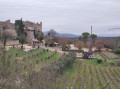
(S/E) After the car park, just to the right, walk through the hamlet, under an arch, temporarily following the sign for “monument”. Stay on the main path until you reach a road.

(1) Follow the road until you reach the campsite, go past it and continue to the Mas de Serret.

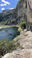
(2) Turn left towards the Gorges de l’Ardèche and follow the signposts. The descent is on a track of earth and stones, under the canopy of trees.
Towards the end of the descent, you’ll come across a sign pointing towards Le Garn.

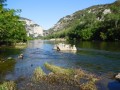
(3) Carry on straight ahead until you reach the Ardèche. Make the most of the easily accessible sandy and pebbly beach to dip your feet in the water, or for a proper swim depending on the season.

(4) Turn back, following your original route markings (yellow and white), until you reach the sign for Le Garn on the left.

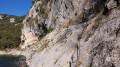
(3) Head steeply uphill towards Le Garn. Along the way, you’ll pass La Baume d’Oullins, a cave that was inhabited before the Ice Age and features rock paintings. It is currently closed to protect it.

(5) Continue the climb until you join theGR® on a DFCI track.

(6) Then turn right, following the oldGR® markings (white and red). Pay attention as several paths will appear: leave theGR® on your left, then ignore the two paths on your right.

(7) At the next junction, continue to the left, towards Labastide de Virac. The path is wide but relatively well-shaded, and winds through the region’s typical vegetation.

(8) You’ll reach the Chêne de l’Homme Mort at a large crossroads with five paths. Carry on straight ahead along the path, leaving plot 127 on your left. The path remains wide and easy to follow.

(9) You’ll come to a large bramble bush, facing two paths. Take the one that continues slightly to the left. About a hundred metres further on, at a junction, take the path that turns sharply left and heads uphill. At the next junction, turn right (you’ll leave a blue trail marker behind you).

White and red markings

(10) When you reach the Mas de Rochers, the road is to your left. Join theGR®4, directly in front of you, and follow it to Labastide de Virac.

White and yellow markings

(11) You’ll arrive in the village opposite the town hall. Just to the left (on the other side of the road) is a water pump where you can top up your water supplies. You then have the option of taking a short detour to explore the village, or even stop for a bite to eat before setting off again.
Leave the town hall on your left, pass the small inn, and take the small road on the left. Then follow the path that continues from there until you reach a crossroads (elevation 279).

(12) At the sign, carry on straight ahead; then, under the canopy of trees, you’ll see a sign for “Les Crotte”. You’ll arrive at the hamlet from the west; when you come to a large wrought-iron gate, turn right and you’ll find the car park (S/E).

Waypoints

  1. S/E : mi 0 - alt. 856 ft - Car park at the hamlet of Les Crottes
  2. 1 : mi 0.72 - alt. 843 ft - Route
  3. 2 : mi 1.4 - alt. 814 ft - Mas de Serret
  4. 3 : mi 2.22 - alt. 243 ft - Junction. Return trip to the Ardèche
  5. 4 : mi 2.29 - alt. 203 ft - Ardèche
  6. 5 : mi 2.7 - alt. 771 ft - Baume d’Oullins
  7. 6 : mi 3.47 - alt. 1,283 ft - Junction with the GR4
  8. 7 : mi 3.7 - alt. 1,283 ft - Junction
  9. 8 : mi 4.55 - alt. 1,198 ft - The Dead Man’s Oak
  10. 9 : mi 5.3 - alt. 902 ft - A thicket of brambles in the middle
  11. 10 : mi 5.93 - alt. 922 ft - Joining the GR4
  12. 11 : mi 6.58 - alt. 827 ft - Labastide-de-Virac
  13. 12 : mi 7.29 - alt. 919 ft - Junction towards Le Gras
  14. S/E : mi 8.4 - alt. 856 ft - Car park at the hamlet of Les Crottes

Notes

Please note that part of this route runs through the Gorges de l’Ardèche Nature Reserve, where it is important to follow the rules (no open fires, keep the area quiet, no camping, and keep pets on a lead).

The climb back up from the Ardèche is steep (though not dangerous); walking poles are a good idea, and you’ll be glad you brought them.

You can stock up on water at Labstide de Virac, or even plan a stop for a meal at a restaurant, if you fancy it.

Worth a visit

In the hamlet of Les Crottes, there is a memorial to those executed during theSecond World War. Follow the signs for ‘monument’.

In Labastide-de-Virac, you can explore the village and its castle, as well as some small craft shops (not all of which are open all year round).

Always be cautious and plan ahead when you're outdoors. Visorando and the author of this route cannot be held responsible for any accidents occurring on this route.

The GR® and PR® markings are the intellectual property of the Fédération Française de Randonnée Pédestre.

Reviews and comments

4.4 / 5
Based on 3 reviews

Reliability of the description
4.7 / 5
Ease of following the route
4 / 5
Route interest
4.7 / 5
millim
millim

Overall rating : 4 / 5

Date of your route : Jun 05, 2026
Reliability of the description : ★★★★☆ Good
Ease of following the route : ★★★★☆ Good
Route interest : ★★★★☆ Good
Very busy route : No

A fairly shaded and varied walk, but with few views.

Machine-translated

Michel VdW
Michel VdW

Overall rating : 5 / 5

Date of your route : Dec 01, 2025
Reliability of the description : ★★★★★ Very good
Ease of following the route : ★★★★★ Very good
Route interest : ★★★★★ Very good
Very busy route : Yes

Very good. First a lovely descent, then a fairly steep climb, at the top of which is a listed cave, though it’s closed off by a wire fence.

Machine-translated

virginieka30
virginieka30

Overall rating : 4.3 / 5

Date of your route : Apr 07, 2025
Reliability of the description : ★★★★★ Very good
Ease of following the route : ★★★☆☆ Average
Route interest : ★★★★★ Very good
Very busy route : Yes

A brilliant route, but towards the gorges there are landslides and log jams along the way, so you’ll need to keep a close eye out and be very careful following the recent flooding.
Take care!!

Machine-translated

Other walks in the area

For more walks, use our search engine .

The GPS track and description are the property of this route's author. Please do not copy them without permission.