Country:
 City:
City:


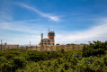
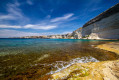
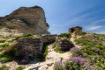
Head towards the Pertusatu Semaphore (military land – no entry); park at the side of the road or in the small car park on the left, but as this is a popular spot, you’ll need to arrive early, or park further down the road (car park by the beach hut); as the end of the road, just past the semaphore, is blocked by a chain, you may need to turn round.
(S/E) You pass the signal box, then the chain. The path (partly tarmac) leads downhill.
(1) The track turns right. Immediately afterwards, as you come out of the bend, leave the road and take the track that climbs straight up to the left, through the scrub (on the right you’ll see the return path). Follow it until you reach the road, then follow the road to the left until you reach the lighthouse. Go round it to the left and continue until you reach a remarkable viewpoint over Pointe Saint-Antoine.
(2) Follow the path that branches off to the left. Shortly afterwards, you’ll come to a slightly wider path; head straight on towards the east until you reach a locked gate.
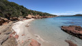
(3) Open the gate and close it behind you, then carry on straight on towards Cala di Sciumara beach. A small, completely secluded beach with a small ruin. Cross the beach and continue along the path that climbs through the maquis, just out of curiosity (this section isn’t particularly interesting; you can skip it and simply turn back on the beach).
(4) Turn round and head back to the gate you passed on the way there.
(3) Follow the track which climbs gently to the right. Pass through another gate. Along the way, you can see a blockhouse on the hill to the right and rejoin the road taken at the start of the walk.
(1) We follow the same route back in the same direction as on the way out to reach the lighthouse again, then the junction 50 metres further on, at the viewpoint.
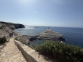
(2) We begin the steep, wide descent to the right towards Saint-Antoine Beach. Once on the beach, we turn left, just to admire the view of Île Saint-Antoine, shaped like a cruiser, and the Pointe (Capu Pertusatu), shaped like a sphinx.
(5) We head back along the beach and begin the climb up the “sphinx” (in fact, we’re at the foot of its head).
(6) From the top of Capu Pertusatu, there are magnificent views of the beach, the Lavezzi Islands, the Orca, the islet of Saint-Antoine and Bonifacio.
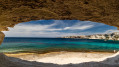
We head back down to visit the cave that opens up in this limestone terrain, known as “l’Orca”. A path takes us down a little way, bringing us to the edge, 5 or 6 metres from the sea. We climb back up and walk round the top, then start the ascent. We rejoin the path leading away from the beach.
(7) We follow it uphill.
(8) Once at the top, leave the main path and turn left. You’ll reach the edge of the cliffs, with stunning views of Saint-Antoine, the Trois Pointes and the town of Bonifacio.
Follow the path, keeping to the left and taking great care! Then return to the junction you’ve already passed twice.
(1) Head back along the route in the opposite direction to return to the car park.
(S/E) Carry on straight ahead, passing the traffic lights.
(9) Shortly afterwards, take a small path on the left, which winds through the low scrubland towards the cliffs. You’ll then walk along this plateau where the remains of the old military batteries are situated. As you approach the edge (be careful!), you’ll look out over the protected area of the Trois Pointes (è Trè Punte)... superb. At the end of this plateau, you’ll spot the bunker below – your next stop.
You then rejoin the road.
(10) You head down to the left-hand bend (to the right of which is a car park with a thatched hut). Take the path on the left that starts just after this bend (there’s an information board about the Trois Pointes area), and head downhill. Once past the ruins of a house (on the left), keep to the left. The path then passes through limestone boulders that have fallen from the cliff, and, amidst these boulders, you reach the casemate (which you can enter) before descending to the seashore.
(11) Behind you, you’ll see a cave in the limestone where you can take a break. Retrace your steps, but turn left straight away to find an easier path. Further on, you have the option of following a less obvious path, which winds through the scrubland alongside the rocks and brings you out upstream of the bend in the road. This is the trail’s intended route, but it is simpler to retrace your steps along the route you took on the way there. You rejoin the road and follow it to the right.
(1O) At the hairpin bend, stay on the road and follow it to the car park (S/E).




 Visorando Member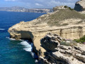
 Easy
Easy 
 Moderate