Monegros Desert

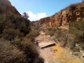
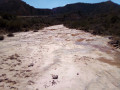
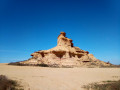
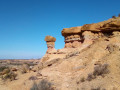
Among Spain’s deserts, the Monegros Desert offers a guaranteed change of scenery thanks to the landscapes and geological formations you’ll discover along this easy walk.

Details

31509032
Creation:
Last update:
Last review:
  • Walking
    Activity: Walking
  • ↔
    Distance: 5.83 mi
  • ◔
    Average duration: 3h 00 
  • ▲
    Difficulty: Easy

  • ⚐
    Back to start: Yes
  • ↗
    Ascent: + 338 ft
  • ↘
    Descent: - 312 ft

  • ▲
    Highest point: 1,014 ft
  • ▼
    Lowest point: 784 ft

Photos

Description of the walk

Access to the (very large) car park at the San Miguel Hermitage is via the A131 road linking the villages of Sarinena and Sena. Leave this road onto a track (which is very bumpy for the first few kilometres) halfway between the two villages. Follow this track, heading south-east, for nearly 7 km to reach the hermitage (don’t hesitate to zigzag to find the best route between the potholes).

(S/E) Take the path heading south (Camino de San Miguel) and you’ll come to a fork at the end of the cultivated field.

(1) Ignore the path branching off to the right (return route) and continue along the track until you reach a sheepfold.

(2) Carry on along the track, which will soon form a wide circular path and, after a few bends, will lead onto a new path, the Camino del Molino.

(3) Turn left and follow the track for about 200 m.

(4) As you come out of the left-hand bend, leave the track and take the path on the right to visit the “Ruta al Tozal de Colasico” site and all its geological features. Follow the official path (usually marked with small wooden stakes driven into the ground), but here the route can change very quickly due to rockfalls. Just wander as best you can, aiming for the most beautiful spots. After your visit, return to the site entrance and the track.

(4) Take this track to the left this time.

(3) At the fork, carry on straight ahead for about fifty metres.

(5) Leave the track and turn right onto a side track, then onto a footpath. Head towards a distinctive hill (Tozal Colasico) visible in the distance, to the west.

(6) When you reach the hill, go round it, keeping it on your right, then head west. Cross the Baranco de la Mata and you will soon come to a fork in the tracks.

(7) Turn left and continue for about 300 m until you reach a bend to the left on the track.

(8) Turn onto the track on the right, heading north, and reach the Baranco de Los Galachos.

(9) Descend into the ravine if it is dry; otherwise, follow the edges. Continue (do not hesitate to climb back up to the edges if the ravine is not passable enough, as shown on the map) until you come out onto a track.

(10) Follow it to the right until you rejoin the route you have already taken.

(1) Turn left until you return to the Hermitage of San Miguel (S/E).

Waypoints

  1. S/E : mi 0 - alt. 784 ft - San Miguel Chapel
  2. 1 : mi 0.32 - alt. 817 ft - A/R junction
  3. 2 : mi 1.3 - alt. 906 ft - Sheepfold
  4. 3 : mi 1.91 - alt. 978 ft - A/R junction
  5. 4 : mi 2.02 - alt. 951 ft - A/R junction
  6. 5 : mi 2.89 - alt. 1,001 ft - Side path to the right
  7. 6 : mi 3.21 - alt. 994 ft - Tozal Colasico
  8. 7 : mi 3.65 - alt. 988 ft - Trail junction
  9. 8 : mi 3.81 - alt. 1,004 ft - Path on the right
  10. 9 : mi 4.02 - alt. 938 ft - Los Galachos Ravine
  11. 10 : mi 4.59 - alt. 886 ft - Track
  12. S/E : mi 5.83 - alt. 784 ft - San Miguel Chapel

Notes

- Avoid entering the ravines if it has rained recently.

- Side paths can be very slippery in wet weather.

- Take water with you and, if necessary, some provisions.

Worth a visit

Take in all the geological features of this remarkable spot.

Reviews and comments

4.7 / 5
Based on 3 reviews

Reliability of the description
4.7 / 5
Ease of following the route
4.3 / 5
Route interest
5 / 5
millim
millim

Overall rating : 4.3 / 5

Date of your route : Aug 12, 2026
Reliability of the description : ★★★★☆ Good
Ease of following the route : ★★★★☆ Good
Route interest : ★★★★★ Very good
Very busy route : No

A really beautiful and interesting walk; doing it at sunrise made it even better
Point 4 is the TOZAL de PEDREGALES area (four different rock formations).
There are small wooden signposts; you can walk all the way round them

Between point 6 and point 7, I couldn’t find a path: I just followed my instincts

On the day of my walk, the access track was in good condition (few potholes).
However, you’ll need to wash your car afterwards!!! It kicks up a lot of dust

Machine-translated

CJCB
CJCB

Overall rating : 4.7 / 5

Date of your route : Nov 19, 2025
Reliability of the description : ★★★★★ Very good
Ease of following the route : ★★★★☆ Good
Route interest : ★★★★★ Very good
Very busy route : No

A lovely afternoon walk. The app's GPS is very useful as the paths are not always marked.
Thanks to the person who organised this hike.

Machine-translated

monein64360
monein64360
• Edited:

A beautiful hike with interesting geological discoveries, but avoid the last part in the ravine when it rains...

Machine-translated

BrunoFlyman
BrunoFlyman

Hello,
Glad you enjoyed the hike!

Machine-translated

claudine Silvestre
claudine Silvestre

Overall rating : 5 / 5

Date of your route : Jun 02, 2025
Reliability of the description : ★★★★★ Very good
Ease of following the route : ★★★★★ Very good
Route interest : ★★★★★ Very good
Very busy route : No

We thoroughly enjoyed this route on a rainy day in the Sierra de Guara, and only had a few drops of rain in the Monegros Desert (less than an hour from Alquézar). The landscape is stunning and unique. The return route through the small ravine is very pleasant. Be sure to follow the GPS track carefully to find the entrance...

Machine-translated

For more walks, use our search engine .

The GPS track and description are the property of this route's author. Please do not copy them without permission.