

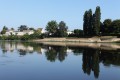
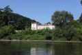

Canoe trip in Pessac-sur-Dordogne

You’ll discover the banks of the Dordogne from a whole new perspective. The flora and fauna are remarkable, and you’ll be able to reach Pessac-sur-Dordogne with little effort, as the gentle current will carry you along.

Details

n°126535
Creation:
Last update:
Last review:
  • Boating/Canoeing/Kayaking
    Activity: Boating/Canoeing/Kayaking
  • ↔
    Distance: 9.03 mi
  • ◔
    Duration according to the author: 3 hrs 
  • ▲
    Difficulty: Easy

  • ⚐
    Back to start: No
  • ↗
    Ascent: + 0 ft
  • ↘
    Descent: - 43 ft

  • ▲
    Highest point: 56 ft
  • ▼
    Lowest point: 13 ft

Photos

Description of the walk

Departure from the quays at Pessac-sur-Dordogne, travelling by bus to Sainte-Foy-la-Grande.

(S) Canoes are launched at Port-Sainte-Foy-et-Ponchapt, on the right bank of the Dordogne.
You’ll paddle down the river for 2 km before reaching the first bend.

(1) Carry on. 3 km further on, on your left, you’ll find Port d’Eynesse, a former wine port.

(2) Carry on for 2.5 km and you’ll see Port de Saint-Aulaye on your right, with its quays, castle and campsite.

(3) Follow the bend to the right, then, 500 metres further on, on your left, you’ll reach the hamlet of Ribebon.

(4) Picnics are possible here; there’s a renovated private château. You can moor if you go to the left of the island. Continue for 600 metres and, after the bend to the left, you’ll reach the unspoilt beach at Le Sablat – perfect for a picnic, a spot of fishing or simply relaxing!

(5) Continue for about 1 km.

(6) You’ll spot the island, which you can approach from either side (the current is slightly stronger on the right).

Once you’ve rounded the island, you’ll have about 2 km to go (2nd island) and you’ll pass under the Pessac-sur-Dordogne bridge (Vidasse Castle on the left before the bridge).

Get out at the second landing stage on the quayside, where you’ll find your vehicles (E).

Waypoints

  1. S : mi 0 - alt. 56 ft - Port-Sainte-Foy and, opposite, Sainte-Foy-la-Grande - Dordogne (fleuve)
  2. 1 : mi 1.44 - alt. 23 ft - 1st bend
  3. 2 : mi 3.45 - alt. 20 ft - Port d’Eynesse
  4. 3 : mi 4.74 - alt. 20 ft - Saint-Aulaye Harbour
  5. 4 : mi 6.4 - alt. 23 ft - Ribebon Castle
  6. 5 : mi 6.98 - alt. 16 ft - Sablat Beach
  7. 6 : mi 7.66 - alt. 16 ft - Before the island
  8. E : mi 9.03 - alt. 13 ft - Vidasse Castle and the quays of Pessac

Notes

If you’d like to canoe down the Dordogne, the Pessac-sur-Dordogne club can transport you and your equipment by coach to Port-Saint-Foy or Eynesse. Please remember to book your time slot on 06 63 82 34 53.

Please note

- Don’t forget to protect yourself from the sun, stay hydrated, wear closed-toe shoes and keep your lifejacket fastened.
- Please respect the anglers and do not throw anything into the river or onto the banks.
- Do not go near piles of branches.

For more information: http://www.canoe-fjep.org
The club is open to the public all summer long!

Reviews and comments

4.7 / 5
Based on 1 review

Reliability of the description
5 / 5
Ease of following the route
5 / 5
Route interest
4 / 5
agnesbauduin
agnesbauduin

Overall rating : 4.7 / 5

Date of your route : Jul 13, 2019
Reliability of the description : ★★★★★ Very good
Ease of following the route : ★★★★★ Very good
Route interest : ★★★★☆ Good

Thank you, visorando

Machine-translated

For more walks, use our search engine .

The GPS track and description are the property of this route's author. Please do not copy them without permission.

