
From Saverne to Haselbourg, returning via the Marne–Rhine Canal

Start with a forest ride of around 10 km, followed by a short stretch on the road to reach Haeselbourg, then the Marne–Rhine Canal near the Artzwiller inclined plane.

Details

n°36328578
Creation:
Last update:
Last review:
  • Touring/Gravel
    Activity: Touring/Gravel
  • ↔
    Distance: 29.86 mi
  • ◔
    Duration according to the author: 3 hrs 
  • ▲
    Difficulty: Moderate

  • ⚐
    Back to start: Yes
  • ↗
    Ascent: + 1,325 ft
  • ↘
    Descent: - 1,348 ft

  • ▲
    Highest point: 1,631 ft
  • ▼
    Lowest point: 577 ft
  • ⚐ Country: France
  • ⚐
  • ⚐ City: Saverne (67700)
  • ⚑
    Start/End: N 48.739305° / E 7.361476°
  • Accessible from the train station Gare de Lutzelbourg.
  • ❏
    IGN map(s): Ref. 3614ET, 3715ET, 3715OT

  • ◶
    Type of surface:
  •  
     
     
    ■ 33% Road ■ 42% Byway ■ 25% Path
  • Hour-by-hour weather

Photos

Description of the route

Park at the Place des Dragons car park, Route de Paris, in Saverne.

(S/E) Head south on the D171, Rue du Général Leclerc, towards Château du Haut Barr. Leave Saverne by following the departmental road and, after a climb, enter the Saverne State Forest and you’ll soon reach the start of a track on the right.

(1) Turn onto this track (unpaved, but cycleable in dry weather), which descends to the right, and leave the departmental road behind, heading towards the château. Keep right at the junctions and, after a 1.5 km descent along a forest track, continue alongside the railway line until you reach the drinking water station.

(2) Just after the drinking water station, turn left onto the Route Forestière de Stammbach to Rheinardsmunster. Follow this tarmac road, at the bottom of the valley, and climb up to the Kempel Forest House.

(3) Carry on straight ahead, then turn left onto the Kempel Forest Road and continue until you reach a crossroad (D98D).

(4) Turn right, pass through Hellert and continue along this road until you reach a junction at the hairpin bend on theD98D at Haselbourg.

(5) Carry on straight ahead along Rue Principale, go round the hill where the ‘Roman Camp’ was situated, and return to the junction with the departmental road.

(5) Carry on to the left towards Lutzelbourg, down a very steep descent, and reach theD98C.

(6) At the junction, turn right and cycle for 1 km until you reach the junction with theD97B. Turn left and enter the car park of the Artzwiller Crystal Works, at the bottom of the ramp.

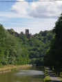
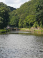
(7) Continue to the far end of the car park, then join the Voie Verte cycle path which runs alongside the canal. From this point, the route follows the Marne–Rhine Canal along the cycle path until you return to Saverne.

(8) Cross the canal to cycle on the left-hand side of the canal, and continue to Lock No. 19.

(9) Change sides of the canal and carry on to Lutzelbourg.

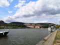
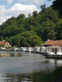
(10) You’ll notice a small river port where mainly hire boats for canal cruises are moored; carry on towards Saverne.

(11) At Lock No. 22, cross the road and continue opposite along the greenway which runs alongside the canal on your left.

(12) Cross the Stuzbach stream and reach a junction at the end of the Quai des Écoles in the centre of Saverne.

(13) Cross the road and continue straight ahead on the cycle path. Ride alongside the harbour basin until you reach No. 24.

(14) Continue along the cycle path beside the canal for a return trip to Lock No. 36 in Steinbourg.

(15) Turn round and return to Saverne via the same route as before, back to the entrance to the harbour basin at No. 24.

(14) Leave the cycle path by turning left, then cross the canal bridge. Continue for about a hundred metres, then take the lane opposite Rue des Jardins. Head towards the harbour basin, go round it on the right and pass in front of the brasserie and the restaurant boats. This is a good spot for a well-deserved break to quench your thirst.

(16) At the roundabout, turn left and cross the first bridge on the left.

(13) Carry on straight ahead and enter the pedestrian zone, pass the Saverne Town Hall, then turn right onto Rue des Églises. At the end of the street, cross the D1004 and enter Place des Dragons (S/E).


Waypoints

  1. S/E : mi 0 - alt. 692 ft - Place des Dragons
  2. 1 : mi 1.01 - alt. 932 ft - Path on the right - Château du Haut-Barr
  3. 2 : mi 2.98 - alt. 669 ft - Drinking water point
  4. 3 : mi 8.39 - alt. 1,509 ft - Kempel Forest House - Kuhbergkopf
  5. 4 : mi 8.86 - alt. 1,601 ft - Departmental road (D98D)
  6. 5 : mi 11.45 - alt. 1,316 ft - Haselbourg
  7. 6 : mi 13.59 - alt. 778 ft - Junction with the D98C - Zorn (rivière)
  8. 7 : mi 14.19 - alt. 751 ft - Artzwiller Crystal Works. Before the - Plan Incliné (Saint-Louis-Arzviller)
  9. 8 : mi 14.83 - alt. 738 ft - Change to the other side of the canal
  10. 9 : mi 15.73 - alt. 725 ft - Lock No. 19
  11. 10 : mi 16.63 - alt. 705 ft - Lutzelbourg river port – Rocher du Petit Moulin
  12. 11 : mi 17.28 - alt. 699 ft - Lock No. 22 – Schlossberg (Lutzelbourg) - Canal de la Marne au Rhin
  13. 12 : mi 18.74 - alt. 669 ft - Stutzbach (cours d'eau) - Affluent de la Zorn
  14. 13 : mi 23.19 - alt. 617 ft - Quai des Écoles – Saverne Locks
  15. 14 : mi 23.66 - alt. 614 ft - No. 24
  16. 15 : mi 26.34 - alt. 577 ft - Steinbourg
  17. 16 : mi 29.33 - alt. 610 ft - Roundabout - Gare de Saverne
  18. S/E : mi 29.86 - alt. 692 ft - Place des Dragons

Notes

(13) You can return to the car park by turning right.

This route can be completed on an e-bike, hybrid bike or mountain bike. It is also suitable for gravel bikes, but not for road bikes.

Worth a visit

A ride through the forest, around the Kempel Forest House.
Visit to Haselbourg – ancient Roman fort – the Virgin and Christ.
Visit to the Artzwiller Crystal Works.
Visit to the Artzwiller inclined plane.
Visit to the Rohans’ Castle in Saverne.
A relaxing break at the harbour basin in Saverne.

Reviews and comments

4.7 / 5
Based on 1 review

Reliability of the description
5 / 5
Ease of following the route
4 / 5
Route interest
5 / 5
User 26764844
• Edited:

Overall rating : 4.7 / 5

Date of your route : Sep 01, 2025
Reliability of the description : ★★★★★ Very good
Ease of following the route : ★★★★☆ Good
Route interest : ★★★★★ Very good
Very busy route : No

A beautiful bike ride between the forest and the Marne-Rhine Canal to Saverne, where you can discover the sloping lake.
You need to be in good shape because there are some steep climbs for a novice like me.
Nevertheless, I highly recommend this route!

Machine-translated

For more walks, use our search engine .

The GPS track and description are the property of this route's author. Please do not copy them without permission.
