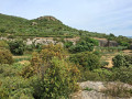
From Saint-Bonnet-du-Gard to Pont du Gard

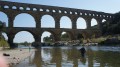
A breathtaking heritage walk leading to one of the most beautiful wonders in France, the Pont du Gard.

Details

32617130
Creation:
Last update:
Last review:
  • Walking
    Activity: Walking
  • ↔
    Distance: 6.25 mi
  • ◔
    Average duration: 3h 35 
  • ▲
    Difficulty: Easy

  • ⚐
    Back to start: Yes
  • ↗
    Ascent: + 837 ft
  • ↘
    Descent: - 820 ft

  • ▲
    Highest point: 476 ft
  • ▼
    Lowest point: 108 ft

Photos

Description of the walk

Park in the car park opposite the town hall.

Red and whiteGR®® markings

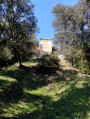
(S/E) From the town hall, head towards the centre of the village, cross the D6086 with care and take Rue de l’Hôtel de Ville opposite. Ignore Rue de l’Horloge on the left, then take the next street and head for Place de la Mairie. Continue uphill along Rue de l’Église. At Place du Porche, carry on straight ahead, passing under the archway, until you reach the fortified church.

(1) After taking in the sights, return to the town hall by following the route back in the opposite direction.

(S/E) Carry on along the small road and, at the three-way junction, turn right and continue to the end of the straight stretch.

(2) Leave the road that branches off to the left and take the path opposite. This leads to a forest track.

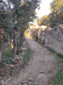
(3) Cross it and carry on straight ahead down a very gentle slope. This stretch through the woodland is very pleasant, especially as it is shaded. You’ll emerge at a junction of paths.

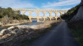
(4) Head up to the left and, after a few metres along a balcony-like path, the Pont du Gard comes into view. Cross a track and head towards the ruins of the Pont de Valmale.

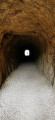
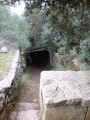
(5) Head up to the right, go through the tunnel and reach the top of the Pont du Gard. Take the steps down to the base of the structure.

(6) Turn left and cross the Gardon.

(7) At the end of the crossing, climb the steps on the right. Follow theGR®® north-westwards then northwards, keeping an eye out for side paths. Further on, you’ll come to a road.

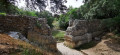
(8) Cross it and follow theGR®®63opposite. The ruins of the Nîmes Aqueduct are located along this stretch. You’ll reach the Pont Roupt.

(9) Follow the same path back in the opposite direction to the ruins of the Valmale Bridge.

Yellow markings

(5) Leave the route you have already taken and walk across the centre of the bridge, then turn right onto the steps and, a few metres further on, follow a path. This turns into a track and, several hundred metres further on, leads to a junction of tracks.

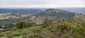
(10) Turn left, pass a water tank (at this point, there is a view of Saint-Bonnet-du-Gard) and arrive back at the junction you have already passed.

Red and white markings

(3) Turn right and follow the route back in the opposite direction to return to the town hall (S/E).

Waypoints

  1. S/E : mi 0 - alt. 157 ft - Car park opposite the Town Hall
  2. 1 : mi 0.22 - alt. 272 ft - Fortified church
  3. 2 : mi 0.81 - alt. 213 ft - Common junction. Out and back
  4. 3 : mi 1.07 - alt. 397 ft - Forest track. Junction of the circular loop
  5. 4 : mi 2.05 - alt. 148 ft - Signpost, trail junction
  6. 5 : mi 2.34 - alt. 200 ft - Ruins of the Valmale Bridge
  7. 6 : mi 2.5 - alt. 118 ft - Pont du Gard
  8. 7 : mi 2.63 - alt. 128 ft - End of the walk across the Pont du Gard - Le Gardon
  9. 8 : mi 3.08 - alt. 197 ft - Road and path junction
  10. 9 : mi 3.4 - alt. 200 ft - Roupt Bridge
  11. 10 : mi 5.34 - alt. 476 ft - Trail junction
  12. S/E : mi 6.25 - alt. 157 ft - Car park opposite the Town Hall

Notes

Watch a video of the walk via the following link: https://youtu.be/CFbn13HhrY8

Please note: there is an error on the IGN map; thefirst section, between (3) and (5), is signpostedGR®®6(White–Red), whilst the return section, between (5) and (3), is signposted onlyPR®® (Yellow)

There is a lovely shaded section between (3) and (4).

On the return leg, after (5), there is very little shade, so a cap and sun cream are strongly recommended.

Worth a visit

Museum area at the Pont du Gard.

The Sernhac Tunnels south of Saint-Bonnet-du-Gard (bring a head torch).

Always be cautious and plan ahead when you're outdoors. Visorando and the author of this route cannot be held responsible for any accidents occurring on this route.

The GR® and PR® markings are the intellectual property of the Fédération Française de Randonnée Pédestre.

Reviews and comments

4.6 / 5
Based on 24 reviews

Reliability of the description
4.6 / 5
Ease of following the route
4.6 / 5
Route interest
4.7 / 5
bruberg
bruberg
• Edited:

Overall rating : 4.7 / 5

Date of your route : Aug 26, 2026
Reliability of the description : ★★★★☆ Good
Ease of following the route : ★★★★★ Very good
Route interest : ★★★★★ Very good
Very busy route : No

The route starts on a very quiet road for about 500 metres, then begins to climb along a very ‘stony’ path. Once at the top, we cut across a forest fire prevention track to head back down via a path through the woodland. We come across several remains of this incredible aqueduct and, after passing through a tunnel, arrive above the Pont du Gard – a magnificent view. We descend the steps to cross the bridge and climb back up the other side, walking alongside the ruins. For the return journey, we follow the same route back as far as an ancient aqueduct we’d already seen on the way out, then turn right through the woodland onto a rather unremarkable track until we reach a viewpoint overlooking the valley and the village of Saint Bonnet, which we return to via the ‘stony’ path we took on the way out. Don’t forget to visit the spring and its wash house near the car park.

Machine-translated

Wan. ie
Wan. ie

Overall rating : 4.7 / 5

Date of your route : May 09, 2026
Reliability of the description : ★★★★★ Very good
Ease of following the route : ★★★★★ Very good
Route interest : ★★★★☆ Good
Very busy route : No

A brilliant hike,

Machine-translated

Ricoborgo
Ricoborgo

Overall rating : 5 / 5

Date of your route : May 06, 2026
Reliability of the description : ★★★★★ Very good
Ease of following the route : ★★★★★ Very good
Route interest : ★★★★★ Very good
Very busy route : No

A beautiful walk, with the Pont du Gard as its main attraction, appearing majestically through the woods. It offers a completely different way of experiencing it compared to the route via the public car park.
The route continues to the ruins of the structure, which is very interesting. The trail presents no particular difficulties: a few climbs, some stones, shaded areas and others in the sun – the joy of hiking! There were plenty of people at the Pont du Gard site, but the paths themselves are very peaceful.
On the way back, Saint-Bonnet-du-Gard is a very pretty, typical medieval village that is definitely worth a visit.

Machine-translated

Dom6269
Dom6269

Overall rating : 4.7 / 5

Date of your route : May 11, 2026
Reliability of the description : ★★★★★ Very good
Ease of following the route : ★★★★★ Very good
Route interest : ★★★★☆ Good
Very busy route : No

A lovely walk that offers a different perspective on the bridge and its surroundings

Machine-translated

User 29089337

Overall rating : 4.3 / 5

Date of your route : May 08, 2026
Reliability of the description : ★★★★☆ Good
Ease of following the route : ★★★★☆ Good
Route interest : ★★★★★ Very good
Very busy route : Yes

A lovely route. But there are still some steep climbs. In my opinion, this hike isn’t easy – it’s of moderate difficulty. The sections with loose stones are tricky.

Machine-translated

Jouanen
Jouanen

Overall rating : 4.7 / 5

Date of your route : Apr 18, 2026
Reliability of the description : ★★★★★ Very good
Ease of following the route : ★★★★☆ Good
Route interest : ★★★★★ Very good
Very busy route : Yes

A brilliant hike. I loved it. The start was a bit tough, but it didn't last long!

Machine-translated

Dom6269
Dom6269

Overall rating : 4.7 / 5

Date of your route : Mar 30, 2026
Reliability of the description : ★★★★☆ Good
Ease of following the route : ★★★★★ Very good
Route interest : ★★★★★ Very good
Very busy route : No

A lovely walk that offers a different perspective on the bridge and its surroundings

Machine-translated

Jipaipai
Jipaipai

Overall rating : 5 / 5

Date of your route : Feb 03, 2026
Reliability of the description : ★★★★★ Very good
Ease of following the route : ★★★★★ Very good
Route interest : ★★★★★ Very good
Very busy route : Yes

The first kilometre was quite challenging, with an uphill path covered in large rocks that we encountered again on the way back, but otherwise, the Pont du Gard is well worth the few kilometres it takes to get there. We had lunch at the restaurant "Les Terrasses", which offered very good value for money. We took lots of photos during this hike, as the site is truly majestic. There were very few people there at the end of January, but this is not the case during the summer months.

Machine-translated

User 4031891

Overall rating : 5 / 5

Date of your route : Dec 15, 2025
Reliability of the description : ★★★★★ Very good
Ease of following the route : ★★★★★ Very good
Route interest : ★★★★★ Very good
Very busy route : No

Very well

Machine-translated

User 27544307

Overall rating : 4 / 5

Date of your route : Nov 28, 2025
Reliability of the description : ★★★★☆ Good
Ease of following the route : ★★★★☆ Good
Route interest : ★★★★☆ Good
Very busy route : Yes

The group is currently learning how to lead walks.
Visorando should help and support us.

Machine-translated

chris2103
chris2103

Overall rating : 5 / 5

Date of your route : Nov 10, 2025
Reliability of the description : ★★★★★ Very good
Ease of following the route : ★★★★★ Very good
Route interest : ★★★★★ Very good
Very busy route : Yes

The frequency is mainly at the Pont du Gard, but it's quiet between St Bonnet and the bridge.

Machine-translated

Bientzat
Bientzat

Overall rating : 4.7 / 5

Date of your route : Oct 07, 2025
Reliability of the description : ★★★★☆ Good
Ease of following the route : ★★★★★ Very good
Route interest : ★★★★★ Very good
Very busy route : No

I really enjoyed this route, which leads to the Pont du Gard through the countryside from Saint Bonnet du Gard. The village is interesting, with its fortified church (unfortunately closed) and fountain. You need good shoes as the path is sometimes stony. It's impossible to get lost with the app. From point 4, there is a short uphill section which is dusty and rutted. Once you arrive at the Pont du Gard site, you'll find it's very busy with tourists. You can have lunch at the restaurant on site. Then, continuing towards points 8 and 9, you'll discover the importance of the aqueduct, which is not limited to the bridge, as you explore the remains of the route. The return to point 10 is a bit tedious and there is no shade.

Machine-translated

User 27025439

Overall rating : 4.3 / 5

Date of your route : Aug 11, 2025
Reliability of the description : ★★★★☆ Good
Ease of following the route : ★★★★☆ Good
Route interest : ★★★★★ Very good
Very busy route : No

A very beautiful way to reach the Pont du Gard.
The path can be a bit difficult at times.
You need good shoes and strong legs, as the path is stony and uphill.
But it's well worth the effort.

Machine-translated

Claude R3.
Claude R3.

Overall rating : 3.7 / 5

Date of your route : May 12, 2025
Reliability of the description : ★★★★☆ Good
Ease of following the route : ★★★☆☆ Average
Route interest : ★★★★☆ Good
Very busy route : Yes

An interesting and popular route, but it can be difficult to follow the markings on the way back, given the number of unmarked paths that are not shown on the map.

Machine-translated

Edipie
Edipie

Overall rating : 4.7 / 5

Date of your route : May 26, 2025
Reliability of the description : ★★★★★ Very good
Ease of following the route : ★★★★☆ Good
Route interest : ★★★★★ Very good
Very busy route : Yes

A very beautiful hike with the added bonus of seeing the Pont du Gard without paying the entrance fee

Machine-translated

Other walks in the area

For more walks, use our search engine .

The GPS track and description are the property of this route's author. Please do not copy them without permission.