From Placy to La Motte

A walk around the village of Placy. Come and discover the history of this charming village and explore the surrounding countryside. Along the way, don’t miss the Château de la Motte, overlooking the Cesny stream.

Details

22096185
Creation:
Last update:
Last review:
  • Walking
    Activity: Walking
  • ↔
    Distance: 4.37 mi
  • ◔
    Average duration: 2h 15 
  • ▲
    Difficulty: Easy

  • ⚐
    Back to start: Yes
  • ↗
    Ascent: + 233 ft
  • ↘
    Descent: - 240 ft

  • ▲
    Highest point: 564 ft
  • ▼
    Lowest point: 400 ft

Photos

Description of the walk

Parking is available in the car park opposite Placy Town Hall.

(S/E) Opposite the town hall, turn right, follow Rue Gournay for about 500 m and ignore the road on the right leading to the 18th-century castle. Continue for about 250 m until you reach a fire hydrant and the sign marking the end of the built-up area.

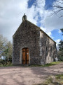
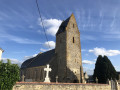
(1) Cross the stream, take the first path on the right and follow it to the end. Alternatively, take a detour of about 200 m to the right to Saint-Firmin’s Church in Placy. Turn left and head towards the calvary.

(2) Cross the D255 with care and, at a place called La Croix, take the first street on the right towards the village of La Motte. Follow the street, continue along the track for about 1.3 km until you reach and cross the Ruisseau de Cesny. Note the bus shelter on the right between the stream and the junction.

(3) At the junction, turn left whilst staying, for reasons of visibility and safety, on the left-hand side of the road, and continue for approximately 200 m. At the Fork in the road, turn left onto the Chemin des Vignes, cross the Ruisseau de Cesny and head uphill to the Château de la Motte.

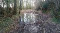
(4) Turn left onto the sunken path that climbs uphill and follow it for about 1 km until you reach a road. Please note that the first 300 metres are rocky and may be slippery when wet (due to rain or runoff).

(5) Turn right, walk for about 150 m and, at the Fork in the road, turn left towards the hamlet of Courts Genêts. After about 100 metres, before reaching the buildings, take the path on the left. Take and follow this path for about 1 km until you reach the D255 road. Please note that the first 200 metres (up to the stream) are rocky and may be slippery when wet (due to rain or running water).

(6) Leave the Chemin du Vieux Pressoir, cross the D255 with care and continue along the Chemin de la Ferme des Prés for about 400 m.

(7) At the Ferme des Prés, continue along the path opposite, negotiate a left-hand bend and carry on until you reach a road. Turn right and walk until you approach the Ferme des Costils.

(8) At the bend, take the path on the left and follow it straight on for about 700 m until you rejoin the D255 road and can see the town hall ahead. Continue to the right and head for the car park (S/E).

Waypoints

  1. S/E : mi 0 - alt. 518 ft - Car park opposite Placy Town Hall
  2. 1 : mi 0.42 - alt. 535 ft - Path on the right after the fire hydrant
  3. 2 : mi 0.67 - alt. 561 ft - The Placy Calvary
  4. 3 : mi 1.53 - alt. 417 ft - At the foot of La Motte, after the Cesny stream
  5. 4 : mi 1.74 - alt. 430 ft - La Motte Castle
  6. 5 : mi 2.37 - alt. 492 ft - Country road
  7. 6 : mi 3.17 - alt. 476 ft - Road D 255
  8. 7 : mi 3.41 - alt. 486 ft - The Ferme des Prés
  9. 8 : mi 3.86 - alt. 466 ft - Near the Costils farm
  10. S/E : mi 4.36 - alt. 518 ft - Car park opposite Placy Town Hall

Notes

The use of walking sticks is recommended as the route takes you along two steep, rocky and slippery paths, which are often damp.

Worth a visit

Placy
Primarily agricultural, this parish has been home to great lords. Inthe 15th century, the Dodeman family appeared in the Cinglais, a region between the Orne and Falaise. Based in Casny-Bois-Halbourt, this family acquired the fief of Placy in 1511.
Traces of the lords of Placy can be found in their coat of arms, described as follows: ‘On a field of azure, a natural owl perched on a sable puppy’. This coat of arms was recently discovered in Placy church whilst a wall was being renovated. The commune has since adopted it as its emblem.

Saint-Firmin’s Church
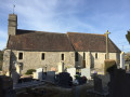
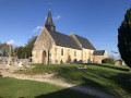
Saint-Firmin’s Church is under the patronage of Val Abbey. The building consists of a chancel and a rectangular nave forming a single structure. The complex dates fromthe 12th or13th century . Inside the church, the coat of arms of the Dodeman family, lords of Placy, appears in several places.

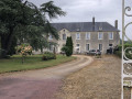
Placy Castle
Placy Castle dates from the16th century.

Reviews and comments

4.5 / 5
Based on 2 reviews

Reliability of the description
5 / 5
Ease of following the route
5 / 5
Route interest
3.5 / 5
jeangazon
jeangazon
• Edited:

Overall rating : 3.5 / 5

Date of your route : Apr 17, 2025
Reliability of the description : Not used / Not applicable
Ease of following the route : ★★★★★ Very good
Route interest : ★★☆☆☆ Disappointing
Very busy route : No

There’s not much to this walk.
Lots of tarmac roads or wide tracks for tractors.
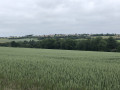
You cross a lot of cultivated fields.

Machine-translated

migref
migref

Overall rating : 5 / 5

Date of your route : Jun 26, 2022
Reliability of the description : ★★★★★ Very good
Ease of following the route : ★★★★★ Very good
Route interest : ★★★★★ Very good
Very busy route : No

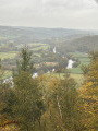
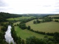
Several shaded sections. A view of ‘Swiss Normandy’ at the end of the walk.

Machine-translated

Other walks in the area

For more walks, use our search engine .

The GPS track and description are the property of this route's author. Please do not copy them without permission.