
From Cassagnabère to the Gorges de la Save by bike

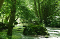
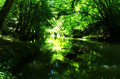
A lovely 30km circular cycle route from the Pré Fixe campsite to the Gorges de la Save, through rolling countryside and offering magnificent views of the Pyrenees. You might want to stop for a picnic along the banks of the Save, with the chance to cool off in the river.

Details

n°1695248
Creation:
Last update:
Last review:
  • Touring/Gravel
    Activity: Touring/Gravel
  • ↔
    Distance: 18.83 mi
  • ◔
    Duration according to the author: 2.5 hrs 
  • ▲
    Difficulty: Moderate

  • ⚐
    Back to start: Yes
  • ↗
    Ascent: + 1,138 ft
  • ↘
    Descent: - 1,155 ft

  • ▲
    Highest point: 1,407 ft
  • ▼
    Lowest point: 935 ft

Photos

Description of the route

Start from the car park at the Pré Fixe campsite in Cassagnabère.

(S/E) Head north, cross the D81 and continue straight on for about a hundred metres.

(1) Turn left onto the D635 (Route de Boulogne-sur-Gesse). Follow this fairly busy road for about 2.5 km.

(2) At the junction with the D98, turn left towards Saman (D98), a much quieter road.

(3) At the junction with the D5, carry straight on along the D98.

(4) Drive through the village of Saman and carry on straight ahead on the D98.

(5) Drive through the village of Charlas and carry on straight ahead. After 400 metres, at a Fork in the road, keep to the right, still on the D98.

(6) At the Stop sign, first turn right then left towards the Cassagne housing estate (stay on the D98).

(7) After 180 metres, at a Fork in the road, turn left. Drive through the hamlet of La Hazeuille.

(8) At the three-way junction (a house with a wrought-iron gate in the shade of a large oak tree), follow the road as it bends to the right.

(9) At the next junction, turn left towards Montmaurin / Gorges de la Save (D98e). After a wooded, steep stretch, pass through the Herré neighbourhood.

(10) At the junction, follow the road to the left to the bottom of the valley: then cross the bridge over the Save.

(11) At the junction just after the bridge, turn right. Follow the river for about 2.8 km, enjoying the cool, shaded gorges.

(12) At the end of the road, turn right onto the D9 and, immediately afterwards, turn right again onto the D98, which winds its way uphill.

(13) At the junction after the hairpin bends, carry on straight ahead. Pass the ruins of Lespugue Castle and enter the village.

(14) At the T-junction, turn left. Drive through the village, past the church, and continue along the D98a.

(15) At the junction, carry on straight ahead until you reach a Stop sign at the junction with the D9.

(7) Then turn left.

(6) At the junction, go straight on along the D98 towards Charlas (the road you took on the way there, but in the opposite direction).

(5) Drive through Charlas and carry on straight ahead.

(4) At Saman, turn right onto the D98d towards Saint-Lary. Cross the bridge over the Nère and drive up the steep hill.

(16) At the junction, veer left.

(17) At the next junction, turn right and, after about a hundred metres, turn left.

(18) At the Fork in the road, keep right towards the D5.

(19) Take the D5 on the right towards Saint-Marcet and Saint-Gaudens. After about 130 metres, once you have crossed the Ruisseau de Saint-Lary, turn left and head uphill onto the D98d.

(20) At the top of this first section of the climb, at the junction, turn right and continue uphill.

(21) At the top of the hill, turn left, pass through the Chaudepisse neighbourhood and follow the D81c.

(22) At a place called La Baraque, the road turns left.

(23) At Barraute, veer left and follow the D81 to the campsite car park on the right (S/E).

Waypoints

  1. S/E : mi 0 - alt. 1,286 ft - Camping Pré Fixe – Car Park
  2. 1 : mi 0.12 - alt. 1,286 ft - D635 road
  3. 2 : mi 1.75 - alt. 1,135 ft - D635 x D98
  4. 3 : mi 3.01 - alt. 1,148 ft - D98 x D5
  5. 4 : mi 4.03 - alt. 1,204 ft - Saman
  6. 5 : mi 5.59 - alt. 1,293 ft - Charlas
  7. 6 : mi 6.25 - alt. 1,345 ft - Junction D98 x D9
  8. 7 : mi 6.37 - alt. 1,355 ft - D8 x D98a fork
  9. 8 : mi 6.98 - alt. 1,391 ft - La Hazeuille
  10. 9 : mi 7.32 - alt. 1,339 ft - Junction of the D98 and D98e
  11. 10 : mi 8 - alt. 1,102 ft - T-junction
  12. 11 : mi 8.27 - alt. 984 ft - Save Gorges – Start
  13. 12 : mi 9.99 - alt. 942 ft - Save Gorges – End
  14. 13 : mi 10.29 - alt. 1,093 ft - Intersection
  15. 14 : mi 10.69 - alt. 1,204 ft - Lespugue
  16. 15 : mi 11.34 - alt. 1,329 ft - Intersection
  17. 16 : mi 15.04 - alt. 1,224 ft - D98d x D5f
  18. 17 : mi 15.19 - alt. 1,204 ft - Crossroads – Cross
  19. 18 : mi 15.71 - alt. 1,119 ft - Fork in the road
  20. 19 : mi 15.98 - alt. 1,083 ft - D5 road
  21. 20 : mi 16.45 - alt. 1,198 ft - Crossroads
  22. 21 : mi 16.69 - alt. 1,260 ft - Chaudepisse
  23. 22 : mi 17.58 - alt. 1,266 ft - La Baraque
  24. 23 : mi 18.53 - alt. 1,283 ft - Barraute
  25. S/E : mi 18.83 - alt. 1,286 ft - Camping Pré Fixe – Car Park

Notes

The region is very hilly, a real treat for cycling enthusiasts and a great sense of achievement when the most beautiful scenery comes into view at the top of the hills.

Worth a visit

You might want to stop for a picnic along the River Save (halfway along the route), with the chance to cool off in the river. You can make the most of this route to visit the Gallo-Roman villa at Montmaurin and take a tour of Lespugue Castle.

The Save Gorges are steeped in history and prehistory. The area has been continuously inhabited since the Palaeolithic period right up to the present day; among other finds, the famous statuette known as the ‘Venus of Lespugue’ and the remains of the Gallo-Roman villa at Montmaurin have been discovered here.

Reviews and comments

4.7 / 5
Based on 1 review

Reliability of the description
5 / 5
Ease of following the route
5 / 5
Route interest
4 / 5
aurelien.soulier@gmail.com
• Edited:

Overall rating : 4.7 / 5

Date of your route : Feb 21, 2024
Reliability of the description : ★★★★★ Very good
Ease of following the route : ★★★★★ Very good
Route interest : ★★★★☆ Good
Very busy route : No

A lovely cycle ride, mostly on roads, but with little traffic

Machine-translated

For more walks, use our search engine .

The GPS track and description are the property of this route's author. Please do not copy them without permission.

