


Day 2💯
Details
Creation:
Last update:
–
–
-
 Activity: Walking
 -
 Distance: 22.88 mi
 -
 Average duration: 11h 10
 -
 Difficulty: Not specified
 -
-
 Back to start: No
 -
 Ascent: + 764 ft
 -
 Descent: - 778 ft
 -
-
 Highest point: 715 ft
 -
 Lowest point: 223 ft
-
 Country:
United Kingdom
Country:
United Kingdom
-
 City:
Uffington
City:
Uffington -
 Start: N 51.58303° / W 1.556197°
 -
 End: N 51.777081° / W 1.649129°
 -


 Hour-by-hour weather


Waypoints
- S : mi 0 - alt. 413 ft - Start on
- 1 : mi 0 - alt. 410 ft - Turn sharp left onto B4507
- 2 : mi 0.05 - alt. 410 ft - Turn sharp right
- 3 : mi 0.27 - alt. 348 ft - Turn right
- 4 : mi 0.46 - alt. 325 ft - Turn slight right
- 5 : mi 0.56 - alt. 315 ft - Turn sharp left
- 6 : mi 0.8 - alt. 312 ft - Turn right onto Broad Way
- 7 : mi 0.81 - alt. 312 ft - Turn left
- 8 : mi 1.37 - alt. 315 ft - Turn slight left onto Woolstone Road
- 9 : mi 1.51 - alt. 322 ft - Turn left onto Woolstone Road
- 10 : mi 2.73 - alt. 692 ft - Turn right
- 11 : mi 3.36 - alt. 679 ft - Turn right onto Knighton Hill
- 12 : mi 4.18 - alt. 463 ft - Turn right onto B4507
- 13 : mi 4.19 - alt. 463 ft - Turn left
- 14 : mi 4.3 - alt. 410 ft - Turn right
- 15 : mi 4.5 - alt. 341 ft - Keep left
- 16 : mi 5.78 - alt. 292 ft - Turn slight left onto Claypit Lane
- 17 : mi 6.58 - alt. 295 ft - Turn slight left onto Majors Road, B4508
- 18 : mi 6.87 - alt. 299 ft - Turn right
- 19 : mi 7.01 - alt. 299 ft - Turn left
- 20 : mi 7.02 - alt. 299 ft - Turn left
- 21 : mi 9.39 - alt. 417 ft - Turn right onto B4019
- 22 : mi 9.84 - alt. 354 ft - Turn left
- 23 : mi 11.13 - alt. 279 ft - Turn slight right
- 24 : mi 11.21 - alt. 279 ft - Turn slight left
- 25 : mi 11.78 - alt. 262 ft - Turn right onto Lechlade Road, A417
- 26 : mi 11.89 - alt. 262 ft - Turn left
- 27 : mi 12.17 - alt. 279 ft - Turn left
- 28 : mi 12.2 - alt. 272 ft - Turn right
- 29 : mi 12.8 - alt. 236 ft - Turn right
- 30 : mi 13.09 - alt. 236 ft - Keep left
- 31 : mi 13.16 - alt. 233 ft - Turn right
- 32 : mi 14.3 - alt. 223 ft - Turn slight left
- 33 : mi 14.82 - alt. 223 ft - Turn left onto Radcot Road, A4095
- 34 : mi 14.9 - alt. 223 ft - Turn left
- 35 : mi 14.93 - alt. 223 ft - Turn right
- 36 : mi 15.14 - alt. 226 ft - Keep right
- 37 : mi 15.8 - alt. 226 ft - Turn left onto Langley Lane
- 38 : mi 15.81 - alt. 226 ft - Turn right
- 39 : mi 16.37 - alt. 233 ft - Turn left
- 40 : mi 16.37 - alt. 233 ft - Turn right
- 41 : mi 16.39 - alt. 233 ft - Turn left
- 42 : mi 17.6 - alt. 240 ft - Turn left onto Calcroft Lane
- 43 : mi 17.95 - alt. 256 ft - Keep right onto Calcroft Lane
- 44 : mi 18.37 - alt. 256 ft - Turn right
- 45 : mi 18.38 - alt. 256 ft - Turn left
- 46 : mi 18.75 - alt. 262 ft - Turn right
- 47 : mi 18.81 - alt. 266 ft - Turn sharp left onto Kings Lane
- 48 : mi 19.03 - alt. 262 ft - Keep right onto Kings Lane
- 49 : mi 19.44 - alt. 289 ft - Turn right onto B4477
- 50 : mi 19.45 - alt. 292 ft - Turn left
- 51 : mi 19.99 - alt. 308 ft - Turn slight right
- 52 : mi 20.11 - alt. 315 ft - Keep left
- 53 : mi 22.07 - alt. 427 ft - Turn right
- E : mi 22.88 - alt. 394 ft
Other walks in the area
Uffington Castle, the White Horse and Wayland's Smithy
 Visorando Member5.93 mi
+574 ft
-545 ft
3h 15
Visorando Member5.93 mi
+574 ft
-545 ft
3h 15
 Easy
Departure from Woolstone (Oxfordshire)
Easy
Departure from Woolstone (Oxfordshire)
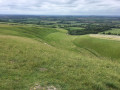
This walk on North Wessex Downs offers some wonderful views as well as the opportunity to explore some fine ancient monuments. These include the Uffington White Horse, Uffington Castle and Wayland's Smithy Long Barrow.
Uffington White Horse and Wayland's Smithy
 3.15 mi
+262 ft
-233 ft
1h 40
Easy
Departure from Woolstone (Oxfordshire)
3.15 mi
+262 ft
-233 ft
1h 40
Easy
Departure from Woolstone (Oxfordshire)
This short walk on the North Wessex Downs offers wonderful and the chance to explore some fine ancient monuments including the Uffungton White Horse, Uffington Castle and Wayland's Smithy Long Barrow.
The Ridgeway, Waylands Smithy and Uffington Castle from Ashdown House
8.20 mi
+525 ft
-541 ft
4h 15
 Moderate
Departure from Ashbury (Oxfordshire)
Moderate
Departure from Ashbury (Oxfordshire)
This walk combines one of the best sections of the Ridgeway and the start of the Lambourn Valley Way with visits to two ancient monuments. It is easy walking; the paths are either well-made or on well-drained chalk downland.
Ashdown House circular via White Horse and Berkshire Border
7.75 mi
+495 ft
-502 ft
4h 00
Moderate
Departure from Ashbury (Oxfordshire)
This circular walk starts from Ashdown House. On the way you will be able to enjoy the White Horse Hill and Alfred’s Castle then spectacular views of the Vale of the White Horse.
Red Barn circular via the Ridgeway, Lambourn
 6.28 mi
+282 ft
-272 ft
3h 10
Moderate
Departure from Lambourn (West Berkshire)
6.28 mi
+282 ft
-272 ft
3h 10
Moderate
Departure from Lambourn (West Berkshire)
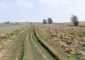
This circular walk brings you will be able to enjoy on a clear day, views across the countryside to Letcombe Bassett, Letcombe Regis, Wantage and even Didcot.
Upper Lambourn via Baydon Hole and Bailey Hill
6.03 mi
+404 ft
-423 ft
3h 10
Easy
Departure from Lambourn (West Berkshire)
A circular walk that brings you from Upper Lambourn via Baydon Hole and Bailey Hill.
For more walks, use our search engine .
The GPS track and description are the property of this route's author. Please do not copy them without permission.

