
In Učka Park: the Poklon–Vojak circular route

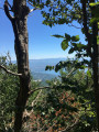
A fairly easy walk to Mount Vojak, the highest point in Istria. A stone tower at the summit offers a superb 360° view across the whole of Istria (as far as Venice and the Italian Alps on a clear day) and over the Kvarner Gulf. In summer, you can enjoy the coolness of the higher altitude and the shelter provided by a forest of tall, imposing beech trees.

Details

24907818
Creation:
Last update:
Last review:
  • Walking
    Activity: Walking
  • ↔
    Distance: 5.15 mi
  • ◔
    Average duration: 3h 45 
  • ▲
    Difficulty: Moderate

  • ⚐
    Back to start: Yes
  • ↗
    Ascent: + 1,591 ft
  • ↘
    Descent: - 1,594 ft

  • ▲
    Highest point: 4,547 ft
  • ▼
    Lowest point: 3,061 ft

Photos

Description of the walk

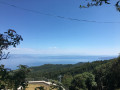
At Poklon, park in the lower car park, which is more shaded. Lovely view over the Kvarner Gulf. Information panels beneath the totem poles.

Marked with red rosettes with a white centre

(S/E) Start from the bottom of the car park, between the wooden huts and the totem poles, on path no. 600, signposted towards “Vojak”. A stony path climbing steadily, zigzagging beneath the beech trees.

(1) Cross the tarmac road (with little traffic) leading to the summit for the first time.

(2) Cross the road again. 100 m further on, stay on the path to the right. Cross the tarmac road for the third time; 100 m further on, leave the track and take the path that climbs to the right. You’ll reach a clearing with a table and information boards. An alternative route is available via path no. 612 to the right.

(3) The path levels out into a balcony-like section, overlooking the sea to the left. You’ll rejoin the tarmac road once more.

(4) Follow it to the right, then, 50 metres further on, take a path uphill to the right, running parallel to the road. Cross over onto the tarmac road to the right and continue to the car park beneath a radome and telecommunications masts. Carry on straight ahead along a concrete path to reach the summit of Mount Vojak.

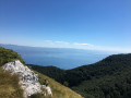
(5) Viewpoint, panoramic views, paragliding take-off point. Magnificent panoramic views taking in the whole of the Kvarner Gulf and the entire Istrian hinterland.
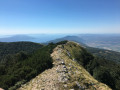
For the return journey, see the possible alternatives under ‘During the hike or nearby’. The standard return route follows the same path as the outward journey. For a bit of variety, our route takes a slightly more challenging path. Continue straight on past the tower along a rocky ridge, initially level, then down a steep slope into an open meadow. Do not cut across the hairpin bends; continue to Sedlo Pass, where there are picnic tables.

(6) Turn right onto path no. 610, which runs along a level, tree-lined ledge. The descent, which is gentle at first, becomes steeper as you go.

(7) When you reach the main road, follow it to the right for about 400 metres , taking care to watch out for traffic.

(8) Turn right onto the tarmac road towards Vojak, which follows path no. 610. Follow this for about 600 metres.

(9) Just as the road takes a sharp bend to the left, take the signposted path to the left, which leads directly to the lower car park (S/E).


Waypoints

  1. S/E : mi 0 - alt. 3,064 ft - Lower car park at the Učka Park Visitor Centre. - Col Poklon
  2. 1 : mi 0.32 - alt. 3,320 ft - Road crossing
  3. 2 : mi 0.63 - alt. 3,688 ft - Road crossing
  4. 3 : mi 1.15 - alt. 4,137 ft - Variant 612 – information board, explanatory panels
  5. 4 : mi 1.61 - alt. 4,360 ft - Road junction, on the right
  6. 5 : mi 2.08 - alt. 4,541 ft - Summit - Mont Vojak (Croatie)
  7. 6 : mi 2.46 - alt. 4,081 ft - Col Sedlo (Croatie)
  8. 7 : mi 4.32 - alt. 3,084 ft - Junction with the main road, on the right
  9. 8 : mi 4.55 - alt. 3,153 ft - Take the 610 on the right,
  10. 9 : mi 4.88 - alt. 3,235 ft - Bend, path on the left
  11. S/E : mi 5.15 - alt. 3,061 ft - Lower car park at the Učka Park Visitor Centre - Col Poklon

Notes

(S/E) On the road from Opatja to Lupoglav and Buzet. Park at Poklon: large, shaded car park. The Park House is 100 m further up, on the opposite side of the road.

Stony path: not accessible to pushchairs or wheelchairs.

Worth a visit

On the way there, at the ‘3 ’, an alternative route via the ‘Plas’ nature trail is possible via path no. 612 (not tested).

For the return journey, there are several options:

  • From the summit, return via the same route as on the way there. The easiest option.
  • From the Col Sedlo (6), return directly by turning right onto path 610 (this route).
  • From Sedlo Pass (6), continue straight ahead uphill on path 611 towards a viewpoint, which joins path 650 on the right, then path 657 on the left, and finally path 630 on the left (not tested).

Reviews and comments

4.7 / 5
Based on 2 reviews

Reliability of the description
5 / 5
Ease of following the route
4.5 / 5
Route interest
4.5 / 5
Lucy-13
Lucy-13

Overall rating : 4.7 / 5

Date of your route : Apr 23, 2026
Reliability of the description : ★★★★★ Very good
Ease of following the route : ★★★★★ Very good
Route interest : ★★★★☆ Good
Very busy route : No

A lovely walk to take in the stunning views from the summit! It’s a fairly quick hike and saves you a return trip; the first part of the descent is steeper but still manageable

Machine-translated

ecdescamps
ecdescamps
• Edited:

Overall rating : 4.7 / 5

Date of your route : Jul 22, 2024
Reliability of the description : ★★★★★ Very good
Ease of following the route : ★★★★☆ Good
Route interest : ★★★★★ Very good
Very busy route : No

A lovely walk, mainly through the forest. The 500-metre elevation gain is fairly evenly spread out. The view from the tower is magnificent. We returned via path 610 as indicated – a very easy route – whereas retracing our steps would no doubt have been more strenuous. We received a very warm welcome at the Visitor Centre, or ‘Maison du Parc’, which has a shop, bar and café… Nearby, starting from this visitor centre, is the start of the ‘Land Art’ trail – a lovely walk, even if quite a few of the artworks are in a state of disrepair. Follow the yellow/green trail and the coloured rectangles (green, then red, then purple and finally orange). Allow about 2 hours 30 minutes.

Machine-translated

For more walks, use our search engine .

The GPS track and description are the property of this route's author. Please do not copy them without permission.
