


CCC 2020 - KM 6
Details
Creation:
Last update:
–
–
-
 Activity: Walking
 -
 Distance: 4.16 mi
 -
 Average duration: 1h 55
 -
 Difficulty: Not specified
 -
-
 Back to start: Yes
 -
 Ascent: + 7 ft
 -
 Descent: - 7 ft
 -
-
 Highest point: 59 ft
 -
 Lowest point: 46 ft
 Country:
 City:
City:


Waypoints
- S/E : mi 0 - alt. 52 ft
- S/E : mi 4.16 - alt. 52 ft
Other walks in the area
Exploring Monte Ceva
 Visorando Member
 8.30 mi
+2,402 ft
-2,411 ft
5h 55
8.30 mi
+2,402 ft
-2,411 ft
5h 55
 Average
 Departure from Montegrotto Terme (Province of Padua)
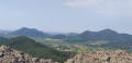
The Monte Ceva–Spinefrasse area is one of the most interesting in the Euganean Hills of Veneto. It resembles a semi-circular amphitheatre of hills, whose peaks do not exceed 255 m in height. Its distinctive geological composition, of volcanic origin, is what makes it unique; combined with the region’s microclimate, this has allowed a natural oasis to form.
For more walks, use our search engine .
The GPS track and description are the property of this route's author. Please do not copy them without permission.

