


Carsington HM
Details
Creation:
Last update:
–
–
-
 Activity: Walking
 -
 Distance: 13.11 mi
 -
 Average duration: 6h 05
 -
 Difficulty: Not specified
 -
-
 Back to start: Yes
 -
 Ascent: + 105 ft
 -
 Descent: - 105 ft
 -
-
 Highest point: 728 ft
 -
 Lowest point: 650 ft
-
 Country:
United Kingdom
Country:
United Kingdom
-
 City:
Hognaston CP
City:
Hognaston CP -
 Start/End: N 53.060328° / W 1.643186°
 -


 Hour-by-hour weather


Waypoints
- S/E : mi 0 - alt. 669 ft
- S/E : mi 13.11 - alt. 669 ft
Other walks in the area
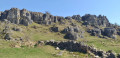
Middleton Top and Harboro Rocks
 Association / Club / Walk leader
 7.31 mi
+594 ft
-597 ft
3h 55
7.31 mi
+594 ft
-597 ft
3h 55
 Moderate
 Departure from Middleton CP (Derbyshire)
A circular walk around Middleton Top area. The 360° view offered by Harboro' Rocks over Carsington Water reservoir is incredible. It is also an opportunity to have a closer look at the windmills.
Tissington Trail stroll
2.85 mi
+75 ft
-108 ft
1h 20
 Easy
Departure from Tissington and Lea Hall CP (Derbyshire)
Easy
Departure from Tissington and Lea Hall CP (Derbyshire)
A mostly level stroll through meadows and along a stretch of the former railway line.
Parwich circular
4.58 mi
+449 ft
-476 ft
2h 30
Moderate
Departure from Tissington and Lea Hall CP (Derbyshire)
Walk to a picturesque village green and pub, returning via pasture land.
Dovedale
8.19 mi
+705 ft
-719 ft
4h 25
 Difficult
Departure from Tissington and Lea Hall CP (Derbyshire)
Difficult
Departure from Tissington and Lea Hall CP (Derbyshire)
An all-day Peak District classic, with refreshment opportunities en route
Fenny Bentley
4.29 mi
+240 ft
-256 ft
2h 10
Easy
Departure from Mapleton CP (Derbyshire)
Along the Bentley Brook to an interesting village and church.
Mappleton & the River Dove
2.18 mi
+187 ft
-200 ft
1h 10
Easy
Departure from Mapleton CP (Derbyshire)
A quick stroll to the village with a brief riverside interlude.
For more walks, use our search engine .
The GPS track and description are the property of this route's author. Please do not copy them without permission.

