
Tréchis circular cycle

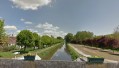
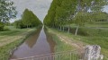
An easy cycle route along the banks of the Canal du Berry and then on the edge of the Sologne region, with few difficulties and just one unpaved section (between the canal and the River Cher before climbing towards Les Tréchis).

Details

n°189044
Creation:
Last update:
Last review:
  • Touring/Gravel
    Activity: Touring/Gravel
  • ↔
    Distance: 12.34 mi
  • ◔
    Duration according to the author: 2 hrs 
  • ▲
    Difficulty: Easy

  • ⚐
    Back to start: Yes
  • ↗
    Ascent: + 210 ft
  • ↘
    Descent: - 220 ft

  • ▲
    Highest point: 423 ft
  • ▼
    Lowest point: 269 ft
  • ⚐ Country: France
  • ⚐
    Area: Sologne
  • ⚐ City: Saint-Julien-sur-Cher (41320)
  • ⚑
    Start/End: N 47.281736° / E 1.773325°
  • ❏
    IGN map(s): Ref. 2122SB, 2123SB, 2222SB, 2223SB

  • ◶
    Type of surface:
  •  
     
     
    ■ 33% Road ■ 34% Byway ■ 33% Path
  • Hour-by-hour weather

Photos

Description of the route

Start at the Place de Saint-Julien-sur-Cher, at the junction of Rue Nationale and Rue de La Fontaine.

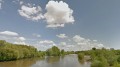
(S/E) Follow the D922 towards Villefranche-sur-Cher and cross the bridge over the Cher.

(1) Just after the bridge, turn right onto the small road running alongside the Villefranche campsite, follow the Cher river and then turn north.

(2) Turn right and follow the track which runs alongside the canal before veering away from it (some ruts and mud possible).

(3) Turn left onto the small road that crosses the canal, then onto the D976 (formerly the N76). Climb the Tréchis hill (short but quite steep).

(4) At Les Tréchis, turn right towards Langon. Turn right again at the second Fork in the road, join the D6 and continue to the right.

(5) Just after passing the water tower on your right, leave the D6 by turning left onto the Route des Prévosts towards the Bois aux Frères.

(6) Cross over the A85 motorway, then pass through the hamlet of Bois aux Frères.

(7) Turn left onto the D76 towards Romorantin.

(8) After about 800 metres, turn left again. Pass under a power line and continue towards the A85 motorway.

(9) Turn sharply left onto the D6 and cross over the A85 again.

(10) Turn right immediately towards Villefranche-sur-Cher.

(11) Turn left near the water tower and head down into Villefranche-sur-Cher.

(12) Cross the railway line. Turn right into Rue de Beauchêne, then into Avenue de Verdun.

(13) Turn left into Rue de la Paix and then immediately right into Rue de la Chevrotterie.

(14) Turn left, heading due south, onto Avenue du Val du Cher (D922).

(1) Cross the River Cher and return to the starting point (S/E).

Waypoints

  1. S/E : mi 0 - alt. 315 ft - Saint-Julien-sur-Cher
  2. 1 : mi 0.4 - alt. 289 ft - The Bridge at > - Le Cher
  3. 2 : mi 1.1 - alt. 282 ft - Berry Canal
  4. 3 : mi 2.49 - alt. 282 ft - Junction
  5. 4 : mi 3.12 - alt. 417 ft - Les Tréchis
  6. 5 : mi 4.15 - alt. 410 ft - Junction
  7. 6 : mi 5.73 - alt. 394 ft - A85 motorway
  8. 7 : mi 7.04 - alt. 354 ft - D76
  9. 8 : mi 7.64 - alt. 361 ft - Junction
  10. 9 : mi 8.94 - alt. 361 ft - D6 junction
  11. 10 : mi 9.23 - alt. 377 ft - Turn right
  12. 11 : mi 10.85 - alt. 381 ft - On the left, near the water tower
  13. 12 : mi 11.13 - alt. 325 ft - Railway line
  14. 13 : mi 11.48 - alt. 289 ft - Rue de la Paix
  15. 14 : mi 11.54 - alt. 289 ft - Avenue du Val du Cher
  16. S/E : mi 12.34 - alt. 315 ft - Saint-Julien-sur-Cher

Notes

Easy parking on the square in Saint-Julien-sur-Cher.

Reviews and comments

4.7 / 5
Based on 1 review

Reliability of the description
5 / 5
Ease of following the route
4 / 5
Route interest
5 / 5
pphilippe
pphilippe

Overall rating : 4.7 / 5

Date of your route : Jul 26, 2022
Reliability of the description : ★★★★★ Very good
Ease of following the route : ★★★★☆ Good
Route interest : ★★★★★ Very good
Very busy route : No

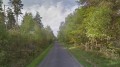
A rather pleasant cycle ride with a well-chosen route: countryside to start with, followed by woodland. In terms of difficulty, the first section, shortly after setting off, takes you along unpaved tracks with a few bumps and potholes: you’ll either love it… or not so much. The climb after crossing the canal is, in fact, short but steep (depending on your fitness level…). There’s little or no motor traffic along the route. All in all, a lovely experience.

Machine-translated

For more walks, use our search engine .

The GPS track and description are the property of this route's author. Please do not copy them without permission.

