Country:
 City:
City:


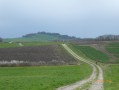
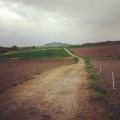
Start from the church in Remenoville.
(S/E) With your back to the church, take Rue Saint-Epvre on the right, then turn left onto Rue de la Barre. Continue for about 500m and turn right towards Moriviller.
(1) Turn left immediately after the pond to enter the woods. After 200m through the woods, take a hunting track on the left to rejoin a road heading towards Rozelieures.
(2) Continue to the right and head for Rozelieures.
(3) Turn onto the white track to the right just before a cowshed and head towards the fields. At the top, turn left, then take the first right. Take care on the descent along the stony track.
(4) At the bottom, turn left and head back towards Rozelieures. When you reach the D22, turn right.
(5) Just after the red bridge, follow the track to the left and cycle through the cow pastures until you reach the crossroads by the military cemetery.
(6) Turn right towards the woods.
(7) At the crossroads of four tracks, continue to the left and join the D134.
(8) Turn left, then right at Saint-Boing. Ride through the village.
(9) At the three-way junction on the way out of the village, follow the small road to the right.
(10) At the entrance to Damas-aux-Bois, turn left onto the D12. After the left-hand bend, pass a farm and turn onto the first track on the right.
(11) At the T-junction, continue to the left and head towards the entrance to Essey-la-Côte.
(12) Just before the farm, take the small grassy track on your left. This skirts round the village on the side of the volcano and leads to the chapel on the other side of the village (D144).
(13) Take the road on the left and head towards the entrance to Vennezey. Follow a grassy path on the left, skirting the village, and rejoin the D144 by turning right as you leave the village.
(14) Turn left; at the junction with the D22, turn left and continue for a few metres.
(15) Continue to the right on the D144. In Remenoville, turn left onto Rue Saint-Epvre and head towards the church (S/E).