Country:
 City:
City:


Park at the Comps arena car park.
(S/E) Take the east exit of the arena, head towards the river on the left, and follow the River Gardon to the fish ladder and the confluence of the Gardon and the Rhône.
(1) Then climb up onto the embankment via the steps and go down the other side. Turn right, heading west, until you reach the D986l.
(2) Take the tarmac path on the other side of the road.
(3) At the junction with the Greenway, turn left towards Beaucaire.
(4) Stay on the Voie Verte and go through the lit tunnel.
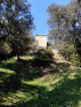
(5) Continue along the Voie verte until you reach the bridge over the road. Just before the bridge, turn right onto the path that descends alongside the road, following the signs for GR®6. The path runs alongside the road, then moves away from it and enters the pine forest. At the junction, take the path on the right and continue straight on until you reach the road.
(6) Turn right, then left, and then take the path on the right again to reach the abbey car park (shaded picnic tables).
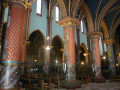
(7) Take the path again at the northern end of the car park. It is a small cobbled path leading towards Saint-Roman Abbey.
(8) At the next junction, you can make a round trip to the abbey by turning right. Otherwise, turn left.
(9) At the junction with the path leading to the Aiguille (a round trip), which offers a lovely view of the abbey, continue along the path straight ahead. Then turn left and then right.
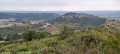
(10) At the junction on the ridge, turn right onto the path that runs along the ridge (a lovely view stretching as far as Mont Ventoux) and descends to the Saint-Romand neighbourhood; walk through the housing estate until you reach the junction with the Voie Verte.
(3) Turn left onto the Voie Verte towards Remoulins. After 400 metres, turn right onto Rue de la Vierge. At the statue of the Virgin Mary, cross the D986l road.
(11) Take the path alongside the Gardon and follow the flood defences.
(12) Take the steps on the right to cross to the other side of the embankment, walk along the left-hand side of the embankment facing the town and head towards the car park (S/E).
 Visorando Member
 Easy
Easy 
 Association / Club / Walk leader