Lagraulet-du-Gers circular loop

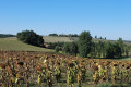
In the heart of the village of Lagraulet-du-Gers, overlooking the surrounding countryside, a pleasant walk through varied landscapes.

Details

4051031
Creation:
Last update:
Last review:
  • Walking
    Activity: Walking
  • ↔
    Distance: 7.73 mi
  • ◔
    Average duration: 4h 05 
  • ▲
    Difficulty: Moderate

  • ⚐
    Back to start: Yes
  • ↗
    Ascent: + 653 ft
  • ↘
    Descent: - 676 ft

  • ▲
    Highest point: 600 ft
  • ▼
    Lowest point: 295 ft

Photos

Description of the walk

Start from the car park in the village square.

(S/E) With your back to the church, walk past the hotel’s gate and turn right. Continue until you find a path branching off to the left and follow it to the hamlet of Lapeyrade. After the houses, turn left onto a tarmac road and turn left again.

(1) Pass the Moulin du Pont, carry on straight ahead and go past the Barranque equestrian centre.

(2) Turn onto the path on the left, which soon branches off to the right. At the next crossroads, turn left and carry on to the Ruisseau de Barranque. Follow this stream until you come to a bridge spanning it. About 100 metres after the bridge, turn left. At the end of the field, turn right and stay on this path until you reach the track leading to the Mignon farm. Turn left and follow it for about 50 metres.

(3) At the junction, turn right. Stay on the track, ignoring the two access roads to Verduzan on your right. Take the next track branching off to the left and continue past the Barthon farm.

(4) Leave the road and take a path that heads off to the right before the hamlet of Bajonnet. Stay on this path, which runs alongside meadows, taking a first bend to the right then a second turn to the left before joining a tarmac road.

(5) Turn right and, at the first junction, turn left towards the Moulin de Jéloux. Pass the mill and continue up the road.

(6) At the bend, take the path branching off to the right. Stay on this path, which winds around the fields until it joins a tarmac road. Turn left, pass a water tower and carry on to the T-junction.

(7) Turn right, then immediately left, and walk through the hamlet of Larroussa. Stay on this road until you reach the hamlet of Gouget.

(8) At the edge of the woods, take the path branching off to your right. Follow this path through the woods, cross the cycle path (Voie Verte) and continue along the path opposite, which leads out of the woods and skirts a small lake.

(9) After the pond, turn right. Stay on the path which leads straight through the hamlet of Nautuc. After the hamlet, at the end of the field, turn right and carry on to the D113.

(10) Turn left, cross a small bridge and immediately leave the road for a path that branches off to the left and winds its way uphill alongside the vineyards to the D254. Turn left and stay on this quiet road until you come to a tarmac track branching off to the left.

(11) Turn slightly left and stay on this track, which crosses the Ruisseau de Tonneteau, then crosses the Voie Verte again before heading up towards the village of Lagraulet. In the village, go straight on to reach the main square and the car park (S/E).

Waypoints

  1. S/E : mi 0 - alt. 551 ft - Car park in the village square
  2. 1 : mi 0.5 - alt. 308 ft - Moulin du Pont junction
  3. 2 : mi 0.95 - alt. 344 ft - Junction
  4. 3 : mi 1.74 - alt. 371 ft - Crossroads
  5. 4 : mi 2.63 - alt. 381 ft - Barthon Farm – Path on the right
  6. 5 : mi 3.01 - alt. 312 ft - Tarmac path
  7. 6 : mi 3.49 - alt. 427 ft - Bend – Path on the right
  8. 7 : mi 4.24 - alt. 584 ft - Crossroads in the hamlet of Micoulau
  9. 8 : mi 5.07 - alt. 525 ft - Crossroads – Gouget hamlet
  10. 9 : mi 5.58 - alt. 394 ft - Lake
  11. 10 : mi 6.33 - alt. 492 ft - Junction with the D113
  12. 11 : mi 7.01 - alt. 413 ft - Tarmac path on the left
  13. S/E : mi 7.73 - alt. 551 ft - Car park in the village square

Notes

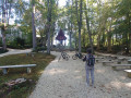
Picnic area on arrival in the village of Lagraulet.

Worth a visit

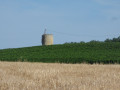
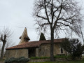
The village of Lagraulet and its water tower, converted into a lodge.

Reviews and comments

3.8 / 5
Based on 4 reviews

Reliability of the description
4 / 5
Ease of following the route
3.3 / 5
Route interest
4.3 / 5
pierreb04
pierreb04

Overall rating : 4 / 5

Date of your route : Nov 11, 2024
Reliability of the description : ★★★★☆ Good
Ease of following the route : ★★★★☆ Good
Route interest : ★★★★☆ Good
Very busy route : No

A few points to bear in mind when walking outside the tourist season: some paths are not maintained and are therefore not always easy to find. A GPS is essential.
At point 2, turn left after the stables at the Barranque equestrian centre or take the path running alongside the next vineyard (shown on the IGN map).
At point 4: just before Bajonnet, turn left and then immediately right to follow the boundary of the property.
Between points 9 and 10, in the hamlet of Nautuc, ongoing works have disrupted the path, which is no longer maintained; you’ll need to turn off towards the D113, then rejoin the signposted path to reach the D254. The grass is tall and the path very muddy at this time of year, so you’ll need good high-top walking boots.

Machine-translated

monein64360
monein64360

Overall rating : 3.7 / 5

Date of your route : May 13, 2024
Reliability of the description : ★★★★☆ Good
Ease of following the route : ★★☆☆☆ Disappointing
Route interest : ★★★★★ Very good
Very busy route : No

Hello,

A lovely walk through the Gers countryside, amongst vineyards, woods and hillsides. Make sure you wear long trousers, and download the route map for this walk before you set off, as the paths could do with some maintenance....

Machine-translated

yannherbert
yannherbert

Overall rating : 4 / 5

Date of your route : Oct 20, 2022
Reliability of the description : ★★★★☆ Good
Ease of following the route : ★★★★☆ Good
Route interest : ★★★★☆ Good
Very busy route : No

A lovely walk with a variety of paths. Well signposted (yellow)
A few sections are slightly obstructed by trees that fell during the storm in August 2022

Machine-translated

Nicole Poussade
Nicole Poussade

Overall rating : 3.7 / 5

Date of your route : Jun 28, 2021
Reliability of the description : ★★★★☆ Good
Ease of following the route : ★★★☆☆ Average
Route interest : ★★★★☆ Good
Very busy route : No

The route is very poorly maintained – the grass is very long and the signposts aren’t very visible; it’s a shame, as it’s a very beautiful route.

Machine-translated

Other walks in the area

For more walks, use our search engine .

The GPS track and description are the property of this route's author. Please do not copy them without permission.