Country:

 City:
City:


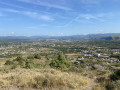
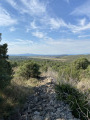
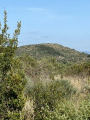
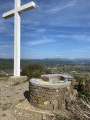
The walk starts from Saint-Sernin, situated about 8 km south of Aubenas towards Voguë.
Park in the station car park (Espace du 14 Juillet), which has been specially laid out for users of the Voie Verte.
(S/E) Follow the Voie Verte towards Voguë-Ruoms until you reach a junction.
(1) Continue for 1.65 km along the Voie Verte until you reach the first bridge over a track.
(2) Turn right then left to leave the Voie Verte and take the path that climbs alongside it. In spring, the path running alongside a vineyard is sometimes closed. In this case, go round the vineyard on the right to rejoin the path a little further up.
Stay on this path as it climbs, crosses a woodland and emerges into another vineyard.
(3) Go round this vineyard on the right. Halfway round, you’ll find, directly in front of you, an unmarked path that starts at a gap in a stone wall. Take this path, head down to a stream and cross it.
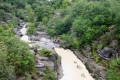
(4) At this point, the path continues along the stream bed before rejoining the bank a few metres further on to the left. You’ll find the same thing a second time a little further on. The path then winds its way along the stream until it joins a small track.
(5) Take this track to the right until you reach a T-junction.
(6) Turn left towards the ridge.
(7) At the top, follow the path to the left towards the water tower. Go round it on the left and continue through the heath until you reach a path marked in yellow and white (elevation 279).
(8) Follow it to the left, north-west, until you reach a junction with another marked path.
(9) Turn right, heading north-east, and follow this path as it heads due north until you reach another fork.
(10) Carry on straight ahead to the summit of Mont Vinobre, marked by a cross (elevation 365).
(11) After taking a break by the orientation table and making your observations, turn back and return to the previous fork.
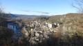
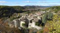
(10) Take the path on the left, heading due east, which descends towards Saint-Sernin (still marked in yellow and white). Enjoy the beautiful view of the village of Voguë from here.
After a fairly steep descent down the Côte de Champel and a short flat section, the path climbs slightly to follow a gently sloping ridge; halfway up, you’ll come to a fork (alt. 235 m).
(12) Turn left onto the signposted path leading to the hamlet of Champel. Cross the hamlet via the tarmac road and rejoin the Voie Verte at the original fork.
(1) Turn left and follow the path back along the same route you took on the way out to reach the station car park (S/E).

 Visorando Member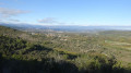

 Easy
Easy