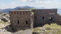
Circular walk to the Tabourde and Pepino forts

The route starts off as a track that’s perfectly suitable for cycling. Then, from Fort Tabourde onwards, it becomes more of a footpath. There aren’t really any technical difficulties, apart from the fact that some sections are quite steep and, above all, the slopes on either side are quite steep – not to say vertiginous. You’ll need to push your bikes along short stretches to avoid taking any risks. The route takes about 3 hours at a leisurely pace, including stops to admire the scenery.

Details

104507063
Creation:
Last update:
Last review:
  • Mountain biking
    Activity: Mountain biking
  • ↔
    Distance: 10.02 mi
  • ◔
    Duration according to the author: 3 hrs 
  • ▲
    Difficulty: Difficult

  • ⚐
    Back to start: Yes
  • ↗
    Ascent: + 1,850 ft
  • ↘
    Descent: - 1,844 ft

  • ▲
    Highest point: 7,500 ft
  • ▼
    Lowest point: 5,896 ft
  • ⚐ Country: Italy
  • ⚐
    Areas: Alps, Mercantour
  • ⚐ City: Limone Piemonte 
  • ⚑
    Start/End: N 44.156044° / E 7.563935°
  • ❏
    IGN map(s): Ref. 3841OT

  • ◶
    Type of surface:
  •  
     
     
     33% Road  34% Byway  33% Path
  • ⇧
    Bike carrying: Not specified
  • ▲
    Difficulty: Difficult
  • Hour-by-hour weather

Photos

Description of the route

The starting point is near Chalet Le Marmotte, in Italy, in the municipality of Limone.

(S/E) Head towards Strada del Sale. Follow this track until you reach the track that branches off to the right.

(1) Take the track, going round the barrier (applies only to motor vehicles), and follow it at a leisurely pace to Fort Tabourbe.

(2) At Fort Tabourbe, take a moment to admire the scenery whilst gazing at the Mercantour massif (Mont Bego, Rocher de l’Abisse, Mont Clapier, etc.). Turn back and take the track signposted ‘Strada del Sale’.

(3) Follow the signs for Strada del Sale. The track soon turns into a relatively wide path.

(4) At this junction, take the path on the right leading towards Fort Pepino. There will be a short section where you may need to push your bike to avoid the risk of falling.

(5) At Fort Pepino, take a moment to admire the view of the Marguareis massif. Depending on the season, you may also see edelweiss there.
Retrace your steps back to the signpost for the Strada del Sale.

(4) Turn right towards the Strada del Sale.

(6) At the junction with the Strada del Sale, take it on the left until you return to Chalet Le Marmotte.


Waypoints

  1. S/E : mi 0 - alt. 5,896 ft - Chalet Le Marmotte
  2. 1 : mi 0.89 - alt. 6,158 ft - Tabourde Fort Trail
  3. 2 : mi 2.35 - alt. 6,480 ft - Fort Tabourde
  4. 3 : mi 2.52 - alt. 6,496 ft - Head towards Strada del Sale
  5. 4 : mi 4.36 - alt. 7,188 ft - Path on the right towards Fort Pepino
  6. 5 : mi 5.54 - alt. 7,421 ft - Fort Pepino
  7. 6 : mi 7 - alt. 7,008 ft - Strada del Sale junction
  8. S/E : mi 10.02 - alt. 5,899 ft - Chalet Le Marmotte

Worth a visit

The views over the Mercantour, the Marguareis and the Limone-Piemonte valley.

For more walks, use our search engine .

The GPS track and description are the property of this route's author. Please do not copy them without permission.