Boël Trail (Sentier du Boël)

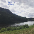
A very pleasant hike. First section at the top of cliffs, with lovely views over the Vilaine river and the site "Moulin du Boël". Cross a shady woodland, then return along the towpath.
To avoid as much as possible passing along the military site's fence ("Le Celar"), this new description uses a slightly more technical part of the GR®.

Technical sheet

50102617
Creation:
Last update:
Last review:
  • Walking
    Activity: Walking
  • ↔
    Distance: 8.05 km
  • ◔
    Average duration: 2h 35 
  • ▲
    Difficulty: Moderate

  • ⚐
    Return to departure point: Yes
  • ↗
    Vertical gain: + 93 m
  • ↘
    Vertical drop: - 92 m

  • ▲
    Highest point: 89 m
  • ▼
    Lowest point: 14 m

Description of the walk

Start: Arriving from "Pont-Réan", park in the car park at the village entrance.

(S/E) From the car park, head towards the pretty old houses opposite the lock and mill.

(1) Pass by the lock. Observe the mill on the opposite bank. Continue along the towpath.

(2) Just before the SNCF* (Railway) bridge over the river, leave the towpath and turn left onto the path leading up to the bridge. A footbridge crosses the river, parallel to the TGV** railway line. At the end of the bridge, turn right onto the road leading down to the river.

(3) Leave the path opposite which leads to the mill site. Turn left, and at the entrance to the car park, follow the GR® path on the left (white and red markings). The path quickly climbs to the heights. Various viewpoints offer magnificent panoramas of the Vilaine river and the Boël site.

(4) Continue following the GR®39. The trail passes slightly away from the military site ("Le CELAR"). Short climbs, sometimes quite steep, but without danger and in a very shady area.

(5) The GR® skirts the fence of the military site, continue straight ahead. Leave the military zone. The GR® passes in front of isolated villas and continues through undergrowth until you arrive at the hamlet of "La Bouchetière".

(6) Continue along the GR® until you reach a place called "Les Vallées".

(7) Leave the GR® on your left and turn right onto the D39, toward "Guichen". We soon come to the bridge over the "Vilaine" river, which we cross. (Beware of heavy traffic at this point).

(8) Leave the road at the end of the bridge. Turn left onto the path leading down to the river. Follow the towpath on the left, pass under the bridge and continue to the car park on the left (S/E).

Waypoints

  1. S/E : km 0 - alt. 16 m - Car Park
  2. 1 : km 0.2 - alt. 16 m - Lock - Vilaine (fleuve)
  3. 2 : km 0.63 - alt. 16 m - Assent onto the SNCF bridge
  4. 3 : km 0.84 - alt. 17 m - Take left
  5. 4 : km 1.37 - alt. 50 m - Follow GR39
  6. 5 : km 2.23 - alt. 55 m - Closure of the Military site
  7. 6 : km 4.28 - alt. 79 m - Village "La Bouchetière"
  8. 7 : km 5.13 - alt. 30 m - D39 to the right
  9. 8 : km 5.51 - alt. 19 m - Path on the left
  10. S/E : km 8.05 - alt. 16 m - Car Park

Practical information

Start: Arriving from "Pont-Réan", park in the car park at the village entrance.

Access: Pass through Pont-Réan (bridge). At the exit, turn left onto the road to "Le Moulin du Boël".

Gears: The trail is not difficult, but good hiking boots or even walking sticks are recommended.

Refreshments: There's a bar/restaurant on the Boël site. There is no other bar/restaurant on the circuit.

Facilities : Laillé village is about 2km from the place named "La Bouchetière". To get there, turn left onto the tarmac road at La Bouchetière. Laillé village offers a full range of shops and services.

  • SNCF = French National Railway Company
    • TGV = High-speed train

 Always stay careful and alert while following a route. Visorando and the author of this walk cannot be held responsible in the event of an accident during this route.

The GR® and PR® markings are the intellectual property of the Fédération Française de Randonnée Pédestre.

Other walks in the area

For more walks, use our search engine .

The GPS track and description are the property of the author. Do not copy them without permission.