


Bedapikehowtown
Details
Creation:
Last update:
-
 Activity: Walking
 -
 Distance: 11.00 mi
 -
 Average duration: 7h 50
 -
 Difficulty: Not specified
 -
-
 Back to start: No
 -
 Ascent: + 3,169 ft
 -
 Descent: - 3,163 ft
 -
-
 Highest point: 2,188 ft
 -
 Lowest point: 476 ft
-
 Country:
United Kingdom
Country:
United Kingdom
-
 Area: Lake District
 -
 City:
Patterdale
City:
Patterdale -
 Start: N 54.53475° / W 2.935378°
 -
 End: N 54.570738° / W 2.86219°
 -


 Hour-by-hour weather


Waypoints
- S : mi 0 - alt. 492 ft - Start on A592
- 1 : mi 0 - alt. 492 ft - Turn slight right onto A592
- 2 : mi 0.15 - alt. 492 ft - Turn left
- 3 : mi 0.37 - alt. 525 ft - Keep left
- 4 : mi 0.42 - alt. 551 ft - Turn slight right
- 5 : mi 0.47 - alt. 597 ft - Turn right
- 6 : mi 0.57 - alt. 679 ft - Keep right
- 7 : mi 1.04 - alt. 1,211 ft - Keep right
- 8 : mi 1.04 - alt. 1,211 ft - Keep left
- 9 : mi 1.06 - alt. 1,217 ft - Keep right
- 10 : mi 1.86 - alt. 1,617 ft - Turn left
- 11 : mi 2.33 - alt. 1,476 ft - Keep left
- 12 : mi 3.03 - alt. 1,568 ft - Keep right
- 13 : mi 3.25 - alt. 1,430 ft - Turn slight right
- 14 : mi 3.47 - alt. 1,093 ft - Turn right
- 15 : mi 3.48 - alt. 1,079 ft - Turn slight right
- 16 : mi 3.76 - alt. 646 ft - Turn left
- 17 : mi 3.91 - alt. 640 ft - Keep right
- 18 : mi 4.07 - alt. 640 ft - Turn right
- 19 : mi 4.09 - alt. 666 ft - Keep right
- 20 : mi 4.66 - alt. 1,181 ft - Turn sharp left
- 21 : mi 4.99 - alt. 1,266 ft - Keep left
- 22 : mi 5.09 - alt. 1,243 ft - Keep left
- 23 : mi 5.28 - alt. 1,368 ft - Keep left
- 24 : mi 5.48 - alt. 1,391 ft - Turn left
- 25 : mi 5.79 - alt. 1,388 ft - Keep left
- 26 : mi 5.8 - alt. 1,394 ft - Turn left
- 27 : mi 6.02 - alt. 1,335 ft - Turn sharp right
- 28 : mi 6.59 - alt. 2,070 ft - Turn left
- 29 : mi 7.61 - alt. 1,995 ft - Keep right
- 30 : mi 8.35 - alt. 1,824 ft - Keep left
- 31 : mi 8.71 - alt. 1,709 ft - Turn left
- 32 : mi 8.92 - alt. 1,732 ft - Turn right
- 33 : mi 8.98 - alt. 1,732 ft - Turn left
- 34 : mi 8.99 - alt. 1,739 ft - Keep left
- 35 : mi 9.51 - alt. 1,604 ft - Turn left
- 36 : mi 9.53 - alt. 1,614 ft - Turn slight right
- 37 : mi 9.62 - alt. 1,657 ft - Keep right
- 38 : mi 9.75 - alt. 1,706 ft - Turn left
- 39 : mi 9.87 - alt. 1,706 ft - Keep right
- 40 : mi 10.19 - alt. 1,339 ft - Turn right
- 41 : mi 10.62 - alt. 584 ft - Turn sharp right
- 42 : mi 10.83 - alt. 597 ft - Turn left
- 43 : mi 10.85 - alt. 541 ft - Turn left
- 44 : mi 10.97 - alt. 479 ft - Turn left
- 45 : mi 10.98 - alt. 479 ft - Turn sharp right
- E : mi 11 - alt. 476 ft
Other walks in the area
Silver Point from Patterdale
 Visorando Member
 4.01 mi
+453 ft
-449 ft
2h 15
4.01 mi
+453 ft
-449 ft
2h 15
 Easy
Departure from Patterdale (Westmorland and Furness)
Easy
Departure from Patterdale (Westmorland and Furness)
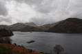
A lovely circular walk from Patterdale going to Silver Point. Gorgeous views on Ullswater lake and the surrounding summits. Dog friendly.
Birks, St. Sunday's, and return via Grisedale
8.95 mi
+2,415 ft
-2,405 ft
6h 15
 Moderate
Departure from Patterdale (Westmorland and Furness)
Moderate
Departure from Patterdale (Westmorland and Furness)
This is a companion route to Birks, St. Sunday, Cofa Pike, Fairfield, Hart Crag & return via Dovedale as it offers a safe way off the mountain should you need a plan B or if you want a walk with less ascent. It is still a great walk in its own right and the descent of Grisedale is a nice contrast to the ascent of St Sunday Crag.
Lanty's Tarn
 3.49 mi
+574 ft
-558 ft
2h 05
Moderate
Departure from Patterdale (Westmorland and Furness)
3.49 mi
+574 ft
-558 ft
2h 05
Moderate
Departure from Patterdale (Westmorland and Furness)
This is a short, low level walk that can fill a couple of hours. Good if you are short on time or if it has been raining most of the day and has cleared up in the late afternoon. Nice views over the lake and interesting scenery.
Circuit of Boredale from Patterdale
11.05 mi
+3,140 ft
-3,130 ft
7h 50
 Difficult
Departure from Patterdale (Westmorland and Furness)
Difficult
Departure from Patterdale (Westmorland and Furness)
A Lake District walk starting from Patterdale that includes Place Fell, Howtown, and Beda Fell in a circuit of Boredale. The scenic content of this route is excellent with Ullswater providing a contrast to the rugged fells all around you.
Angletarn Pikes, The Knott, High Street and Threshwaite Cove; Circular
 11.28 mi
+2,779 ft
-2,762 ft
7h 35
Moderate
Departure from Patterdale (Westmorland and Furness)
11.28 mi
+2,779 ft
-2,762 ft
7h 35
Moderate
Departure from Patterdale (Westmorland and Furness)
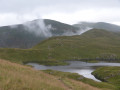
A circular walk from Patterdale which ascends gradually to take in the great views from Angletarn Pikes and The Knott before passing over the Straits of Riggingdale to High Street and The Beacon at Thornwaite Crag. It then descends Threshwaite Cove to Hartsop and a return to Patterdale.
Birks, St. Sunday, Cofa Pike, Fairfield, Hart Crag & return via Dovedale.
 10.14 mi
+3,114 ft
-3,087 ft
7h 25
Difficult
Departure from Patterdale (Westmorland and Furness)
10.14 mi
+3,114 ft
-3,087 ft
7h 25
Difficult
Departure from Patterdale (Westmorland and Furness)
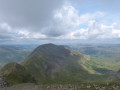
This is a great circular walk, taking in some of the higher tops and with a descent via the tranquil and less frequented Dovedale.
YHA hopping in The Lake District - YHA Patterdale to YHA Keswick
 Association / Club / Walk leader18.81 mi
+4,931 ft
-5,157 ft
12h 55
Association / Club / Walk leader18.81 mi
+4,931 ft
-5,157 ft
12h 55
 Very difficult
Departure from Patterdale (Westmorland and Furness)
Very difficult
Departure from Patterdale (Westmorland and Furness)
The YHA is a great institution and I guess most fell walkers have stayed at a hostel at some time in their lives. Funny how they were created "to help all, especially young people of limited means, to a greater knowledge, love and care of the countryside, particularly by providing hostels or other simple accommodation for them on their travels". Here's a collection of routes starting or finishing at a YHA in The Lakes. Along the way are 8 Wainwrights, 2 lakes, 1 tarn and 1 pub
For more walks, use our search engine .
The GPS track and description are the property of this route's author. Please do not copy them without permission.

