


Starting and finishing points: the village of Avlemonas in the south-east of the island. Easy to park your car.
Avlemonas, Agios Georgios and Diakofti


A circular walk on the island of Kythira in Greece. It starts from the village of Avlemonas in the south-east of the island. It is a beautiful but challenging circular route. `Do not underestimate the distance and the elevation gain.
Details
Creation:
Last update:
Last review:
–
–
-
 Activity: Walking
 -
 Distance: 9.96 mi
 -
 Average duration: 6h 40
 -
 Difficulty: Difficult
 -
-
 Back to start: Yes
 -
 Ascent: + 2,362 ft
 -
 Descent: - 2,372 ft
 -
-
 Highest point: 1,214 ft
 -
 Lowest point: -3 ft
-
 Country:
Greece
Country:
Greece
-
 Start/End: N 36.227037° / E 23.081385°
 -


 Hour-by-hour weather
Description of the walk
Waypoints
- S/E : mi 0 - alt. 23 ft - Avlemonas
- 1 : mi 2.11 - alt. 971 ft - Agios Georgios
- 2 : mi 5.95 - alt. 10 ft - Diakofti
- S/E : mi 9.96 - alt. 20 ft - Avlemonas
Worth a visit
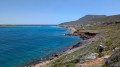
From Avlemonas, the hike gains altitude! An initial ascent of 320 metres leads to Agios Georgios, an ancient Minoan site dedicated to the moon, crowned by a Byzantine chapel. Along the way, you can enjoy superb views over the bays of Diakofti and Palaiopoli.
You then continue northwards to the monastery of Agia Moni and its Byzantine church adorned with icons, before reaching Diakofti, the island’s main port, where the wreck of the Nordland still rises from the waves.
The return journey to Avlemonas follows the east coast, past spectacular rock formations and mysterious islets home to the remains of a sanctuary dedicated to Poseidon and a Byzantine fortress.
Other walks in the area
Kapsali and Kastro Chora
 Visorando Member2.38 mi
+600 ft
-597 ft
1h 35
Visorando Member2.38 mi
+600 ft
-597 ft
1h 35
 Easy
Easy
 Departure from Greece
A short circular walk on the island of Kythira, 3.6 km long with a 184 m elevation gain, starting from Kapsali in the south of the island. An easy little walk allowing you to explore the old town of Chora and its Kastro. A beautiful view of the island of Hytra.
Kapsali and the Cave of Agia Sophia
4.08 mi
+807 ft
-810 ft
2h 35
 Moderate
Departure from Greece
Moderate
Departure from Greece
A short circular walk on the island of Kythira starting from the village of Kapsali, taking you to the Agia Sophia cave with its chapel adorned with icons. This walk offers superb panoramic views.
Circular walk from Chora via Feloti and Agios Demetrios
7.89 mi
+1,243 ft
-1,243 ft
4h 45
Moderate
Departure from Greece
A circular walk on the island of Kythira, starting from Chora and ending in Kapsali. This circular walk takes you to the secluded church of Agios Dimitrios and the peaceful cove of Feloti with its chapel in the cave of Agia Pelagia.
From Agia Pelagia to Diakofti on the island of Kythira
 6.97 mi
+1,066 ft
-1,089 ft
4h 10
Moderate
Departure from Greece
6.97 mi
+1,066 ft
-1,089 ft
4h 10
Moderate
Departure from Greece
Kythira (in Greek Kythira) is an island situated fifteen kilometres south of the Peloponnese. It offers a number of archaeological sites and pleasant sandy beaches in summer. This is a coastal walk between Agia Pelagia (Sainte-Pélagie) and Diakofti. There are magnificent views and an abandoned shepherds’ village.
Mylopotamos and the Valley of the Watermills
3.06 mi
+482 ft
-482 ft
1h 50
Easy
Departure from Greece
A picturesque circular route on the island of Kythera, Greece, starting from the village of Mylopotamos in the Valley of the Watermills. The route winds through a wooded valley with a refreshing atmosphere
From Potamos to Paleochora
5.56 mi
+666 ft
-692 ft
3h 10
Moderate
Departure from Greece
A circular walk on the island of Kythira, Greece, from Potamos to Paleochora. This is the former Byzantine capital of Kythira, also known as the Castle of Agios Dimitrios, built between two gorges.
From Agia Pelagia to Lake Kakia Langada
3.45 mi
+367 ft
-351 ft
1h 55
Easy
Departure from Greece
A short walk on the island of Kythira, from Agia Pelagia in the north of the island to Kakia Langada Lake. Tucked away at the foot of the imposing cliffs of the Paleochora Gorge, this hidden gem offers a breathtaking natural spectacle.
Plateia Ammos, Cape Spathi and Agios Nikolaos Beach
4.60 mi
+627 ft
-597 ft
2h 40
Moderate
Departure from Greece
A lovely circular walk on the island of Kythira, in Greece, starting from Plateia Ammos in the north of the island. It takes you to Cape Spathi Agios and Nikolaos Beach, with its charming chapel and breathtaking views.
For more walks, use our search engine .
The GPS track and description are the property of this route's author. Please do not copy them without permission.

