Around the Grouin du Cou Lighthouse and the Dune de Paris

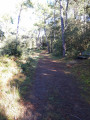
A short walk for days when the weather is bad, taking in woodland, dunes and a holiday resort area with architecture typical of seaside villages.

Details

16228753
Creation:
Last update:
Last review:
  • Mountain biking
    Activity: Mountain biking
  • ↔
    Distance: 3.02 mi
  • ◔
    Duration according to the author: 1 hr 
  • ▲
    Difficulty: Easy

  • ⚐
    Back to start: Yes
  • ↗
    Ascent: + 30 ft
  • ↘
    Descent: - 30 ft

  • ▲
    Highest point: 56 ft
  • ▼
    Lowest point: 20 ft
  • ⚐ Country: France
  • ⚐
  • ⚐ City: La Tranche-sur-Mer (85360)
  • ⚑
    Start/End: N 46.347027° / W 1.448283°
  • ❏
    IGN map(s): Ref. 1328OT

  • ◶
    Type of surface:
  •  
     
     
     33% Road  34% Byway  33% Path
  • ⇧
    Bike carrying: Not specified
  • ▲
    Difficulty: Easy
  • Hour-by-hour weather

Photos

Description of the route

Start at the car park of the Les Floralies Cultural Centre.

(S/E) Follow Boulevard de la Petite Hollande to the right as you leave the car park, then go straight on along Rue de la Coquille Saint-Jacques. Go round the roundabout and continue straight on. Turn right onto Rue des Saumons and, after 150 m, pass Rue des Étrilles on your left and follow Rue des Saumons as it turns left.

(1) Turn right onto Rue du Phare. Further on, go round a roundabout and continue straight ahead along Rue du Phare.
You’ll see the lighthouse on your right; continue along Allée de la Youte. Carry on along Rue des Brisans, ignoring the cul-de-sac opposite, and turn right. This will take you onto Allée des Baleineaux, then turn left onto Allée des Algues.

(2) At the roundabout, turn right onto Allée du Corps de Garde, then take the first left onto Rue du Fond des Rois, which bends right twice.

(3) Just after the second bend, take the small path leading uphill to the left. At the crossroads, turn left onto the GR® 8, which bends to the right; then, when it bends to the left, leave it and carry on straight ahead until you reach the cross-country track. Turn right and follow it for about a hundred metres until you reach the cycle path.

(4) Cross this cycle path and the Route du Phare à la Terrière, then head into the woods. At the Fork in the road that appears shortly afterwards, take the path marked in yellow, keeping completely to the right for about 350 metres.

(5) At the next T-junction, turn sharply to the right (west), and at the first Fork in the road, turn left (south-west).
At the junction of perpendicular paths, continue straight ahead and, at the next junction, turn left (south).

(6) Without reaching the houses, at the four-way junction, take the Chemin du Pare du Feu to the left (east), then continue along Rue du Pare Feu until you reach Rue de la Coquille Saint-Jacques. Follow this road to the left to reach the car park at the Pôle Culturel Les Floralies (S/E).

Waypoints

  1. S/E : mi 0 - alt. 26 ft - Car park at the Les Floralies Cultural Centre
  2. 1 : mi 0.41 - alt. 23 ft - Rue du Phare
  3. 2 : mi 1.31 - alt. 20 ft - Small roundabout
  4. 3 : mi 1.48 - alt. 23 ft - Forest path
  5. 4 : mi 1.94 - alt. 52 ft - Route du Phare to La Terrière
  6. 5 : mi 2.18 - alt. 49 ft - Junction
  7. 6 : mi 2.45 - alt. 39 ft - Chemin du Pare Feu
  8. S/E : mi 3.02 - alt. 26 ft - Car park at the Les Floralies Cultural Centre

Always be cautious and plan ahead when you're outdoors. Visorando and the author of this route cannot be held responsible for any accidents occurring on this route.

The GR® and PR® markings are the intellectual property of the Fédération Française de Randonnée Pédestre.

Reviews and comments

3.7 / 5
Based on 5 reviews

Reliability of the description
3.6 / 5
Ease of following the route
3.4 / 5
Route interest
4 / 5
User 26613224

Overall rating : 5 / 5

Date of your route : Oct 08, 2025
Reliability of the description : ★★★★★ Very good
Ease of following the route : ★★★★★ Very good
Route interest : ★★★★★ Very good
Very busy route : No

We enjoyed this route. We liked it so much that we did it again in the opposite direction, and even though it was the same path, the route felt different. No particular difficulties. Few people around when we visited in early October 2025.

Machine-translated

Laurent S85
Laurent S85
• Edited:

Overall rating : 3.7 / 5

Date of your route : Feb 17, 2025
Reliability of the description : ★★★☆☆ Average
Ease of following the route : ★★★☆☆ Average
Route interest : ★★★★★ Very good
Very busy route : No

I am well aware that criticism is easy and art is difficult! In the urban section, the description is clear and unambiguous, even though we come across Rue des Saumons on our left for the first time without having to turn down it.
In the woodland section, there are three sources of misleading directions:
(3) “At the crossroads, turn left onto the GR® 8.” In fact, this refers to the second crossroads; if you take the first one, you’ll end up walking alongside the houses you’ve just left behind. Furthermore, at the second crossroads, the GR8 isn’t signposted – only the yellow and green signposts are visible. It’s only further on that you’ll find any sign of the GR8.
(4) “At the next junction, turn sharply right.” There are several junctions before you reach this one…
(5) “At the four-way junction, take the Chemin du Pare-feu to the left, then continue along Rue du Pare-feu.” There are several four-way junctions and, what’s more, for the uninitiated, what on earth is a “Chemin du Pare-feu”?

That said, it’s a lovely little walk, and thank you to those whose descriptions have enabled us to enjoy it!

Machine-translated

rondeauyannick
rondeauyannick

Overall rating : 4 / 5

Date of your route : Sep 09, 2024
Reliability of the description : ★★★★☆ Good
Ease of following the route : ★★★★☆ Good
Route interest : ★★★★☆ Good
Very busy route : No

A lovely walk through the woods and dunes, back along the beach. Not very busy, but it was the first week of September...

Machine-translated

milet
milet

Overall rating : 2.3 / 5

Date of your route : May 29, 2023
Reliability of the description : ★★☆☆☆ Disappointing
Ease of following the route : ★★☆☆☆ Disappointing
Route interest : ★★★☆☆ Average
Very busy route : No

This route involves too much walking through “housing estates”. The description is good up to point 3; after that, it gets tricky – the GR isn’t signposted in some places, and after the rest area it becomes more difficult to make sure you don’t miss the entrance to the small wood.
Across all your routes, there’s a lack of information on the number of kilometres of footpath and tarmac, and sometimes no reference to the existing signposting.

Machine-translated

Matthieu49
Matthieu49

Overall rating : 3.3 / 5

Date of your route : May 22, 2023
Reliability of the description : ★★★★☆ Good
Ease of following the route : ★★★☆☆ Average
Route interest : ★★★☆☆ Average
Very busy route : No

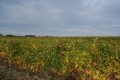
Part of the route runs through an open area following a fairly recent clear-cut in the forest.

Machine-translated

For more walks, use our search engine .

The GPS track and description are the property of this route's author. Please do not copy them without permission.