Around Padern Castle

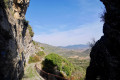
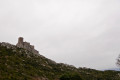
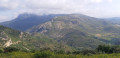
Padern is a pretty village in the Hautes Corbières where a fortress was built in the 17th century; although now in ruins, high walls still stand perched on the cliff, remnants of the Cathar era.⁠⁠⁠⁠⁠⁠⁠⁠

Details

n°70165220
Creation:
Last update:
Last review:
  • Walking
    Activity: Walking
  • ↔
    Distance: 2.42 mi
  • ◔
    Average duration: 1h 35 
  • ▲
    Difficulty: Easy

  • ⚐
    Back to start: Yes
  • ↗
    Ascent: + 518 ft
  • ↘
    Descent: - 518 ft

  • ▲
    Highest point: 1,161 ft
  • ▼
    Lowest point: 636 ft

Photos

Description of the walk

Park on the riverside in the large car park. Easy parking opposite the Verdouble (river).

(S/E) Cross the road and head up Rue du Cers on the right. After a few houses, on the right, there is a sign pointing to the castle and the chapel. Take the small steps leading to the Chapelle Saint-Roch.

(1) Continue by turning left at the chapel onto the path that leads past the castle ruins, where a sign informs you that climbing on the ruins is prohibited (risk of falling rocks).

(2) From this sign, take the small path on the left which climbs steeply through the forest and joins a forest track.

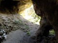
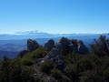
(3) Turn left onto it and head uphill through the pine forest, then descend gently. Ignore the yellow-marked path on your right and continue straight ahead along the forest track, which winds down in several hairpin bends towards the village. Continue along the tarmac road leading to the village.

(4) Walk through the village. At the Fork in the road, head down to the right along Rue Sainte-Cécile, which leads onto the main road.

(5) Carry on straight ahead along Rue du Confluent (D14), which takes you back to the starting point (S/E).

Waypoints

  1. S/E : mi 0 - alt. 643 ft - Large car park - Verdouble (rivière)
  2. 1 : mi 0.17 - alt. 705 ft - Chapelle Saint-Roch (Padern)
  3. 2 : mi 0.37 - alt. 869 ft - Castle (ruins off limits)
  4. 3 : mi 0.62 - alt. 1,030 ft - Forest track
  5. 4 : mi 2.1 - alt. 666 ft - Road junction
  6. 5 : mi 2.27 - alt. 636 ft - Main road (D14)
  7. S/E : mi 2.42 - alt. 643 ft - Large car park - Verdouble (rivière)

Worth a visit

The GR®367 links several Cathar castles: Queribus, Peyrepertuse, etc.

Always be cautious and plan ahead when you're outdoors. Visorando and the author of this route cannot be held responsible for any accidents occurring on this route.

The GR® and PR® markings are the intellectual property of the Fédération Française de Randonnée Pédestre.

Reviews and comments

4.7 / 5
Based on 1 review

Reliability of the description
5 / 5
Ease of following the route
5 / 5
Route interest
4 / 5
bpier
bpier

Overall rating : 4.7 / 5

Date of your route : May 18, 2026
Reliability of the description : ★★★★★ Very good
Ease of following the route : ★★★★★ Very good
Route interest : ★★★★☆ Good
Very busy route : No

A lovely walk.

Machine-translated

Other walks in the area

For more walks, use our search engine .

The GPS track and description are the property of this route's author. Please do not copy them without permission.