Country:

 City:


Car park opposite Guiry-en-Vexin Castle.
(S/E) With your back to the car park, turn right onto Rue Saint-Nicolas towards Wy-Dit-Joli-Village.
(1) At the Ru de Guiry, leave the D159 and turn left onto the road leading to Gadancourt.
(2) In the village, pass the château and the church. Carry on straight ahead along Rue des Bruyères, which leads to the village exit. Cross the road leading to Wy-dit-joli-Village and continue along the road opposite.
(3) Before the bend in the road (cross), turn right onto the track and, after about a hundred metres, turn 90° to the right towards Wy-dit-joli-Village.
(4) Just past the first house, turn right onto Rue Henri IV and follow it to the left; then, at the three-way roundabout, go straight on along Rue de la Mairie. Pass the town hall, then the Musée de l’Outil.
(5) Turn slightly left in front of the church to follow Rue Saint-Romain, then turn right to leave the village. Pass the cemetery and you’ll come out onto the D175.
(6) Follow it to the right until you reach a house (the former railway station).
(7) Turn right onto the road towards the Morval Departmental Forest and reach the edge of the forest.
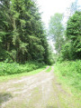
(8) Turn right onto the main track for 20 metres, then keep left onto the forest track that crosses the valley. After about 500 metres, head up to the left onto the other side of the valley. At the top, the path turns right and reaches a fork.
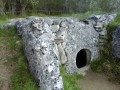
(9) Be sure to carry on to the Allée Couverte du Bois-Couturier by turning left.
(10) Return along the same path for about a hundred metres and head down to the left, towards the south, through the woodland until you reach the main path.
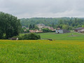
(11) Take this path on the left. A large meadow with picnic tables occupies the bottom of the valley. Turn left onto the road that leads down to the castle car park (S/E).
 Visorando Member
 Moderate


 Association / Club / Walk leader