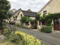
Around Crissay-sur-Manse

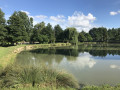
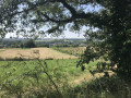
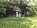
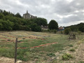
A lovely walk, 75 per cent of which is on paths, much of it through woodland. You’ll pass through the village of Crissay-sur-Manse, listed as one of the “most beautiful villages in France”. You’ll then walk past the ruins of the Collégiale des Roches Tranchelion.

Details

n°1371249
Creation:
Last update:
Last review:
  • Mountain biking
    Activity: Mountain biking
  • ↔
    Distance: 19.14 mi
  • ◔
    Duration according to the author: 2.5 hrs 
  • ▲
    Difficulty: Easy

  • ⚐
    Back to start: Yes
  • ↗
    Ascent: + 919 ft
  • ↘
    Descent: - 902 ft

  • ▲
    Highest point: 371 ft
  • ▼
    Lowest point: 148 ft
  • ⚐ Country: France
  • ⚐ City: Saint-Épain (37800)
  • ⚑
    Start/End: N 47.144601° / E 0.536906°
  • ❏
    IGN map(s): Ref. 1723ET, 1823SB, 1824SB

  • ◶
    Type of surface: Not specified
  • ⇧
    Bike carrying: Not specified
  • ▲
    Difficulty: Not specified
  • Hour-by-hour weather

Photos

Description of the route

(S/E) Set off from the town hall square heading due south.

(1) Turn left onto Rue Jeanne d’Arc and continue along the path.
(2) Turn right towards La Grossinaye and cross the D57.

(3) Turn right, follow the first path on the left towards the woods and turn left at the junction.
(4) Turn right and take the first path on the left, the Sentier des Fougères. Follow it until you reach a road.

(5) Turn left onto the D208, then take the first track on the right, which will cross a new road. First turn left then right.
(6) Turn left and continue in the same west-north-westerly direction.

(7) Turn right onto the road, then take the first road on the left towards La Manse.
(8) Turn left and carry on straight ahead.

(9) Turn right, cross the river, then take the first road on the right towards Crissay-sur-Manse (D457).
(10) Take the track on the right and, at the foot of the church, turn left to cross the village, first turning right then left.

(11) Turn left and take the first road on the right. Pass La Jolivière.
(12) Take thePR® path at the foot of the collegiate church and cross the Crissay Forest.

(13) Leave thePR® path, which heads due north, and continue to the right, heading due east, until you reach the entrance to Neuil.
(14) Turn right onto the path leading up towards Crissay and turn left towards the Ferme des Vallées.

(15) Just past the farm, take the path leading uphill to the left, cross the D457 and head towards La Boisselière.
(16) Follow the path to the left and turn right at Valdingue.

(17) Turn right twice, then, a little further on, turn left towards Moulins.
(18) At the foot of the grain silo, turn right onto the path leading up towards the D57.

(19) Turn left and take the first path on the right. Turn right towards Le Gros Buisson and follow the signs for “Caves”.
(20) Turn left, then right to return via the D8 to Saint-Épain (S/E).

Waypoints

  1. S/E : mi 0 - alt. 190 ft - Town Hall Square
  2. 1 : mi 0.3 - alt. 177 ft - Rue Jeanne d’Arc
  3. 2 : mi 0.97 - alt. 184 ft - Towards Le Grossinaye
  4. 3 : mi 1.66 - alt. 318 ft - Bouillet
  5. 4 : mi 2.6 - alt. 312 ft - Boizé Forest
  6. 5 : mi 6.75 - alt. 328 ft - La Morelière
  7. 6 : mi 7.5 - alt. 285 ft - La Meunerie
  8. 7 : mi 8.27 - alt. 154 ft - T-junction: turn left.
  9. 8 : mi 8.84 - alt. 151 ft - The River Manse
  10. 9 : mi 9.4 - alt. 243 ft - Crissay-sur-Manse
  11. 10 : mi 10.55 - alt. 351 ft - Carroi de la Grange
  12. 11 : mi 11.42 - alt. 197 ft - Les Roches Tranchelion - Collégiale des Roches Tranchelion
  13. 12 : mi 12.65 - alt. 371 ft - Withdrawal from the PR
  14. 13 : mi 13.55 - alt. 266 ft - Neuil
  15. 14 : mi 14.85 - alt. 230 ft - Les Vallées
  16. 15 : mi 15.2 - alt. 246 ft - La Boisselière
  17. 16 : mi 15.65 - alt. 276 ft - Junction after Valdingue
  18. 17 : mi 16.59 - alt. 285 ft - Moulins
  19. 18 : mi 17.31 - alt. 364 ft - D57
  20. 19 : mi 18.69 - alt. 259 ft - Les Caves
  21. S/E : mi 19.14 - alt. 190 ft - Saint-Épain

Notes

Provisions: all shops in the village of Saint-Épain
Recommended car park: the Deneux car park, 300 metres from the town hall.
Camping and caravan site on the banks of the village pond.

Worth a visit

Visit to the village of Crissay-sur-Manse, listed as “One of the Most Beautiful Villages in France”, and a tour of the ruins of the Collégiale des Roches Tranchelion.

Always be cautious and plan ahead when you're outdoors. Visorando and the author of this route cannot be held responsible for any accidents occurring on this route.

The GR® and PR® markings are the intellectual property of the Fédération Française de Randonnée Pédestre.

Reviews and comments

4.7 / 5
Based on 1 review

Reliability of the description
5 / 5
Ease of following the route
5 / 5
Route interest
4 / 5
Calou37
Calou37

Overall rating : 4.7 / 5

Date of your route : Sep 16, 2024
Reliability of the description : ★★★★★ Very good
Ease of following the route : ★★★★★ Very good
Route interest : ★★★★☆ Good
Very busy route : No

A gently undulating route with open stretches and woodland.
The village of Crissai-sur-Manse is very pretty.

Machine-translated

For more walks, use our search engine .

The GPS track and description are the property of this route's author. Please do not copy them without permission.