Ascent of the Montagnola crater

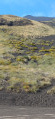
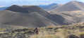
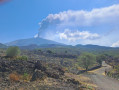
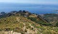
A very pleasant and varied hike in the Etna massif. The first section up to the ridge is an easy walk through typical vegetation, first through woodland and then through ‘high-altitude savannah’, with a beautiful view of the coast. From the ridge, there’s a splendid view of the Del Bove valley and Mount Etna. Then the steeper ascent along the ridge takes you into a whole new world. The vegetation gradually disappears, giving way to volcanic scoria.

Details

60596159
Creation:
Last update:
Last review:
  • Walking
    Activity: Walking
  • ↔
    Distance: 5.12 mi
  • ◔
    Average duration: 4h 50 
  • ▲
    Difficulty: Difficult

  • ⚐
    Back to start: Yes
  • ↗
    Ascent: + 2,851 ft
  • ↘
    Descent: - 2,838 ft

  • ▲
    Highest point: 8,612 ft
  • ▼
    Lowest point: 6,024 ft

Photos

Description of the walk

Park in the car park on Via Cassone.

(S/E) Follow the path signposted ‘sentiero Schiena dell’Asino’, behind the barrier. Up to the ridge, the path is marked in red and white. It is wide and clearly visible.

(1) Turn left and follow the ridge line towards the summit.

(2) When you reach a steeper section, look out for a small, barely marked pass on the left to go round it. Follow the path over the pass.

(3) Turn right to rejoin the ridge and continue towards the summit. At around 2,500 m, there is a flat area with a few rocks marking the end of the ridge. From there, the summit is just a stone’s throw away. Continue straight on towards it.

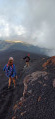
(4) Cross the descent path on the left and head straight on. The slope becomes steeper and the slag-covered ground increasingly unstable underfoot. Reach the Montagnola crater (2,648 m).

(5) Retrace your steps.

(4) Turn right onto the steeply sloping path.

(6) At the first junction, continue to the left towards the two craters, Calcarazzi and Corvo. Walk around them.

(7) Descend from them via the path leading towards the Silvestri crater.

(8) On a flat section at an altitude of 2,000 m, cut left across the slag towards the road below.

(9) Once on the road leading down from the Sapienza Refuge, turn left and, a little further down, you’ll reach the car park where you started (S/E).

Waypoints

  1. S/E : mi 0 - alt. 6,024 ft - Car park
  2. 1 : mi 1.43 - alt. 6,591 ft - Ridge
  3. 2 : mi 1.76 - alt. 6,841 ft - Cliff
  4. 3 : mi 1.86 - alt. 6,814 ft - Exit from the path
  5. 4 : mi 2.88 - alt. 8,301 ft - Northern junction of the circular loop
  6. 5 : mi 3.11 - alt. 8,524 ft - Montagnola (2648 m)
  7. 6 : mi 3.98 - alt. 7,008 ft - Junction
  8. 7 : mi 4.45 - alt. 6,680 ft - Path junction
  9. 8 : mi 4.54 - alt. 6,558 ft - Flat section
  10. 9 : mi 4.88 - alt. 6,129 ft - Road junction
  11. S/E : mi 5.12 - alt. 6,024 ft - Car park

Notes

On the second section, as you approach the summit, the path sometimes disappears. You’ll need to find your own way through the slag and stay as close as possible to the original route.
High-top shoes are recommended. The slag is abrasive and very dusty. Otherwise, trainers are fine.

Reviews and comments

4.8 / 5
Based on 2 reviews

Reliability of the description
5 / 5
Ease of following the route
4.5 / 5
Route interest
5 / 5
Charly38112
Charly38112

Overall rating : 5 / 5

Date of your route : Apr 24, 2025
Reliability of the description : ★★★★★ Very good
Ease of following the route : ★★★★★ Very good
Route interest : ★★★★★ Very good
Very busy route : No

A brilliant hike on Mount Etna, away from the crowds!

Machine-translated

Sèv84
Sèv84

Overall rating : 4.7 / 5

Date of your route : Sep 06, 2024
Reliability of the description : ★★★★★ Very good
Ease of following the route : ★★★★☆ Good
Route interest : ★★★★★ Very good
Very busy route : No

A lovely circular route on the eastern slopes of Mount Etna, far from the crowds at the tourist starting points. Free roadside parking.
Stunning views from start to finish. The first section through the forest is very pleasant and helps get your legs ready for the rest of the walk.
We encountered no difficulties. There were no particular technical challenges, apart from the climb on the final section to reach the Montagnola crater.
We carried on as far as the Piano del Lago or Escriva crater. The crowds and tourist coaches visible in the distance on the higher craters put us off going any higher.
The route description is accurate. A few quick glances at the IGN map were enough to confirm the directions.

I’d really recommend this walk, which lets you explore this area away from the crowds and the commercial side of organised tours.
Check the weather forecast carefully – conditions can change quickly.
Make sure you’re well kitted out – you’ll soon be exposed to full sun and wind on the ridge. Don’t hesitate to set off early.

Thanks for this lovely route.
Enjoy the hike, everyone – don’t hesitate, it’s absolutely stunning!

Machine-translated

For more walks, use our search engine .

The GPS track and description are the property of this route's author. Please do not copy them without permission.