


Arheimsfjellet, Skrefjellet and Hoven from Oppheim


A must-do in the Loen region. This hike takes you up two peaks in succession, offering breathtaking views of the fjord and the glacial lakes of Lovatnet and Oldevatnet. The route is very well signposted and provides views across the entire valley, without needing to take the Loen cable car.
Details
Creation:
Last update:
Last review:
–
–
-
 Activity: Walking
 -
 Distance: 9.39 mi
 -
 Average duration: 7h 45
 -
 Difficulty: Very difficult
 -
-
 Back to start: Yes
 -
 Ascent: + 3,980 ft
 -
 Descent: - 3,996 ft
 -
-
 Highest point: 3,688 ft
 -
 Lowest point: 935 ft
-
 Country:
Norway
Country:
Norway
-
 Start/End: N 61.880396° / E 6.789619°
 -


 Hour-by-hour weather


Waypoints
- S/E : mi 0 - alt. 951 ft - Car park
- 1 : mi 0.73 - alt. 1,962 ft - Crossroads
- 2 : mi 1.27 - alt. 2,684 ft - Fork
- 3 : mi 2.47 - alt. 3,235 ft - Arheimsfjellet
- 4 : mi 5.62 - alt. 3,675 ft - Skrefjellet
- 5 : mi 6.77 - alt. 3,133 ft - Hoven
- S/E : mi 9.39 - alt. 935 ft - Car park
Other walks in the area
Skageflå to Geiranger
 Visorando Member
 4.40 mi
+2,477 ft
-2,733 ft
4h 10
4.40 mi
+2,477 ft
-2,733 ft
4h 10
 Difficult
 Departure from Norway
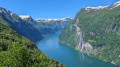
A spectacular walk along the right-hand bank of the Geirangerfjord, a UNESCO World Heritage Site.From the shore, you’ll climb to an altitude of 580 m before returning to Geiranger via the mountains. All along the way, you’ll be able to admire the fjord and its mountains, with their snow-capped peaks.
For more walks, use our search engine .
The GPS track and description are the property of this route's author. Please do not copy them without permission.

