Aqua de Pau and Lagoa do Fogo

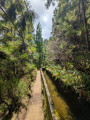
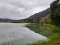
A round trip to a crater lake from the car park beside the road. A magnificent view on the descent, followed by an easy walk along the lake’s edge. Only the return journey, which is uphill, is a bit of a physical challenge. A wild landscape.

Details

n°111503453
Creation:
Last update:
Last review:
–
  • Walking
    Activity: Walking
  • ↔
    Distance: 2.15 mi
  • ◔
    Average duration: 1h 20 
  • ▲
    Difficulty: Moderate

  • ⚐
    Back to start: Yes
  • ↗
    Ascent: + 427 ft
  • ↘
    Descent: - 427 ft

  • ▲
    Highest point: 2,320 ft
  • ▼
    Lowest point: 1,877 ft

Description of the walk

Start from the road linking Ribeira Grande (to the north) and Remédios (to the south). Park in the large car park situated on a bend, near the Lagoa do Fogo viewpoint.

(S/E) Head south-west and walk towards the viewpoint.

(1) Turn left and begin the descent. This is via steps and ends with a five-metre ladder.

(2) Turn left and walk alongside the large lake (Aqua de Pau) on your right. This will take you to the edge of the small lake, Lagoa do Fogo.

(3) The return journey follows the same route as the outward journey, but in the opposite direction, back to the car park (S/E).

Waypoints

  1. S/E : mi 0 - alt. 2,303 ft - Car park by the roadside
  2. 1 : mi 0.12 - alt. 2,303 ft - Viewpoint
  3. 2 : mi 0.37 - alt. 1,909 ft - Aqua de Pau
  4. 3 : mi 1.07 - alt. 1,906 ft - Lagoa do Fogo
  5. S/E : mi 2.15 - alt. 2,303 ft - Car park by the roadside

Other walks in the area

For more walks, use our search engine .

The GPS track and description are the property of this route's author. Please do not copy them without permission.