


Fullarton Woods, Troon
For more info visit https://gillianswalks.com/2024/10/26/fullarton-woods/
Details
Creation:
Last update:
-
 Activity: Walking
 -
 Distance: 1.48 mi
 -
 Duration calculated by the app: 51min
 -
 Difficulty: Easy
 -
-
 Back to start: Yes
 -
 Ascent: + 66 ft
 -
 Descent: - 66 ft
 -
-
 Highest point: 121 ft
 -
 Lowest point: 43 ft
-
 Country:
United Kingdom
Country:
United Kingdom
-
 City:
South Ayrshire
City:
South Ayrshire -
 Start/End: N 55.537507° / W 4.62378°
 -


 Hour-by-hour weather


Waypoints
- S/E : mi 0 - alt. 75 ft
- 1 : mi 0.35 - alt. 62 ft - Left to cross bridge
- 2 : mi 0.53 - alt. 46 ft - At the corner go left onto minor path
- 3 : mi 0.59 - alt. 43 ft - Right at footbridge
- 4 : mi 0.82 - alt. 69 ft - Small hill
- 5 : mi 1.23 - alt. 112 ft - Turn right at gate onto road
- S/E : mi 1.48 - alt. 79 ft
Other walks in the area
Troon to Irvine
 Tourism professional
 6.80 mi
+16 ft
-13 ft
3h 10
Easy
6.80 mi
+16 ft
-13 ft
3h 10
Easy
 Departure from South Ayrshire
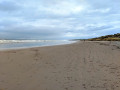
This section of the Ayrshire Coastal Path is basically a long stretch of golden beach sandwiched between two busy coastal towns. Enjoy having a nosey at the shorefront houses in Barassie as you pass, and look out for the stone dragon atop the sand dunes of Irvine Beach! On a clear day the Isle of Arran can be seen across the Firth of Clyde.
Prestwick to Troon Sea & Golf Route
 8.02 mi
+30 ft
-26 ft
3h 45
Easy
Departure from South Ayrshire
8.02 mi
+30 ft
-26 ft
3h 45
Easy
Departure from South Ayrshire
This route follows the Ayrshire Coastal Path between Prestwick and Troon, running alongside both Prestwick and Royal Troon Golf courses. The return leg forms a semi-loop by joining the NCN7 cycle track and then the Smuggler’s Trail across Royal Troon Golf Course. Enjoy the stunning views out across the Firth of Clyde!
Ballast Bank, Troon
 2.36 mi
+10 ft
-10 ft
1h 05
Easy
Departure from South Ayrshire
2.36 mi
+10 ft
-10 ft
1h 05
Easy
Departure from South Ayrshire
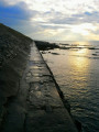
You will begin by walking along a stone footpath built into the side of the Ballast Bank, followed by a stroll along the promenade towards Troon South Beach where there is an excellent play park for the kids to enjoy. On the return, try the path across the top of the Ballast Bank instead – you will be treated to spectacular views across the Firth of Clyde on a clear day.
Ayrshire Smuggler's Trail
 6.47 mi
+194 ft
-322 ft
3h 10
Easy
Departure from South Ayrshire
6.47 mi
+194 ft
-322 ft
3h 10
Easy
Departure from South Ayrshire
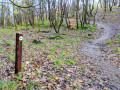
Follow this ancient route between Dundonald and Troon, used in the 18th century to smuggle illegal goods inland! It covers a varied terrain including woodland paths, tarmac roads, grass and sand. You will pass a quiet reservoir, walk through Fullarton Woods then across Royal Troon Golf Course, finishing it off with a stroll along Troon’s sandy Beach.
Old Auchans House, Dundonald
 2.49 mi
+240 ft
-226 ft
1h 20
2.49 mi
+240 ft
-226 ft
1h 20
 Moderate
Departure from South Ayrshire
Moderate
Departure from South Ayrshire
Wandering though this delightful woodland, the impressive remains of 16th century Old Auchans House seem to appear out of nowhere. Go late January to see snowdrops galore, late April for wild garlic, and May for a sea of bluebells!
Milgarholm Park, Irvine
 Association / Club / Walk leader0.75 mi
+23 ft
-23 ft
0h 20
Easy
Departure from North Ayshire
Association / Club / Walk leader0.75 mi
+23 ft
-23 ft
0h 20
Easy
Departure from North Ayshire
A short circular riverside walk in amenity parkland. Mainly flat tarmac surfaces with some gentle inclines.
Irvine to Kilmarnock via Cycle Track
 7.16 mi
+161 ft
-33 ft
3h 25
Easy
Departure from North Ayshire
7.16 mi
+161 ft
-33 ft
3h 25
Easy
Departure from North Ayshire
This easy linear walk starts in Milgarholm Park, Irvine and ends on Munro Avenue, Kilmarnock. Since it is a cycle track it is great for buggies.
Blue Bonnet Trails Circular, Ayr
 7.21 mi
+69 ft
-69 ft
3h 20
Easy
Departure from South Ayrshire
7.21 mi
+69 ft
-69 ft
3h 20
Easy
Departure from South Ayrshire
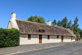
The fully way-marked Blue Bonnet Trails follow the journey taken from Ayr Town Centre to Alloway by Tam o’ Shanter as recounted in one of the most famous poems ever written by Robert Burns. The route described below combines the 2 Blue Bonnet Trails and forms a loop. The walk passes many points of interest along the way including Burns Cottage and Alloway's famous Auld Kirk and it also passes through both Belleisle and Rozelle Parks.
For more walks, use our search engine .
The GPS track and description are the property of this route's author. Please do not copy them without permission.

