


Kilmarnock, Kilmaurs & Knockentiber Circuit
For more info visit https://gillianswalks.com/2016/05/02/kilmaurs-knockentiber/
Details
Creation:
Last update:
-
 Activity: Walking
-
 Distance: 7.39 mi
-
 Average duration: 3h 30
-
 Difficulty: Easy
-
-
 Back to start: Yes
-
 Ascent: + 131 ft
-
 Descent: - 151 ft
-
-
 Highest point: 230 ft
-
 Lowest point: 95 ft
-
 Country:
United Kingdom
-
 City:
East Ayrshire
-
 Start/End: N 55.619611° / W 4.510688°
-


 Hour-by-hour weather


Waypoints
- S/E : mi 0 - alt. 210 ft
- S/E : mi 7.39 - alt. 210 ft
Other walks in the area
Kay Park, Kilmarnock
 Association / Club / Walk leader0.65 mi
+30 ft
-30 ft
0h 20
Easy
 Departure from East Ayrshire
This is an amenity park walk on tarmac surfaces with some gentle gradients.
Kay Park with Kilmarnock Water section
0.98 mi
+36 ft
-33 ft
0h 30
Easy
Departure from East Ayrshire
This is an amenity park walk on tarmac surfaces with some steeper gradients.
Dean Castle Country Park via Borland
 Tourism professional
 2.71 mi
+95 ft
-95 ft
1h 20
Easy
Departure from East Ayrshire
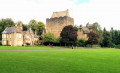
A beautiful countryside walk into the popular Dean Castle Country Park, taking in both Fenwick Water and Craufurdland Water. There are options to extend to visit the castle, Rural Life Centre, duck ponds and kids play area.
Knockentiber Circular
 2.53 mi
+36 ft
-36 ft
1h 10
Easy
Departure from North Ayshire
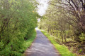
A pleasant short walk along quiet country roads and the cycle path, starting in the village of Knockentiber.
Craufurdland Countryside (Grassyards Road)
 4.97 mi
+171 ft
-154 ft
2h 25
Easy
Departure from East Ayrshire
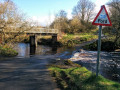
An ideal walk for the longer Spring and Summer evenings. After passing through the Craufurdland Estate, you will spend the majority of the walk out in the open countryside, from where you can admire the views on a clear day.
Knockentiber / Springside 7km Loop
 4.38 mi
+125 ft
-128 ft
2h 05
Easy
Departure from North Ayshire
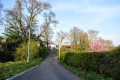
A great walk between the Ayrshire villages of Knockentiber and Springside. The outward route follows the NCN73 Kilmarnock-Irvine cycle track into Springside and returns via the quiet Knockentiber Road. Lovely views from the highest points, including down into Crosshouse and over to the Isle of Arran.
Knockentiber / Springside 9km Loop
 5.69 mi
+95 ft
-98 ft
2h 40
Easy
Departure from North Ayshire
Starting in the village of Knockentiber, this route uses a small section of the NCN73 cycle track before heading out into open countryside, following quiet country roads onto the Overtoun Rd leading to Springside. The return is via the Knockentiber. Road - a single track road offering fine views down to Crosshouse and back towards the Isle of Arran on a clear day.
Craufurdland Countryside (Field Path)
 4.34 mi
+121 ft
-108 ft
2h 05
Easy
Departure from East Ayrshire
A walk for the more adventurous! Quiet country roads quickly lead into the woodland of Craufurdland Estate. You will pass the fishing loch and the Laird’s Table cafe/restaurant, as well as cross a ford (using the footbridge!) The return leg of the walk is via a public right of way across farmland.
For more walks, use our search engine .
The GPS track and description are the property of this route's author. Please do not copy them without permission.

