


Auchinleck to Sorn via the Lost Village of Darnconner
Details
Creation:
Last update:
–
–
-
 Activity: Walking
 -
 Distance: 5.77 mi
 -
 Average duration: 2h 45
 -
 Difficulty: Easy
 -
-
 Back to start: No
 -
 Ascent: + 154 ft
 -
 Descent: - 269 ft
 -
-
 Highest point: 643 ft
 -
 Lowest point: 374 ft
-
 Country:
United Kingdom
Country:
United Kingdom
-
 City:
East Ayrshire
City:
East Ayrshire -
 Start: N 55.471843° / W 4.292609°
 -
 End: N 55.512951° / W 4.29805°
 -


 Hour-by-hour weather


Waypoints
- S : mi 0 - alt. 518 ft - The Boswell Centre, Auchinleck
- 1 : mi 0.44 - alt. 554 ft - Keep left
- 2 : mi 0.52 - alt. 551 ft - Keep left
- 3 : mi 0.58 - alt. 548 ft - Keep left
- 4 : mi 0.68 - alt. 538 ft - Stay high
- 5 : mi 0.75 - alt. 535 ft - Turn right off main track
- 6 : mi 0.89 - alt. 541 ft - Ford - if water too high turn left
- 7 : mi 1.05 - alt. 551 ft - Turn right to cross burn
- 8 : mi 1.09 - alt. 554 ft - Burn on your left
- 9 : mi 1.16 - alt. 558 ft - Up to overhead cables
- 10 : mi 1.18 - alt. 558 ft - Main path - turn left
- 11 : mi 1.27 - alt. 564 ft - Big metal gate
- 12 : mi 1.33 - alt. 571 ft - Left along road
- 13 : mi 1.62 - alt. 561 ft - Turn left
- 14 : mi 1.65 - alt. 564 ft - Turn right
- 15 : mi 2.07 - alt. 581 ft - Turn L along edge of deer fencing
- 16 : mi 2.12 - alt. 574 ft - Caution! Potential flooding in ditch!
- 17 : mi 2.28 - alt. 591 ft - Turn L around edge of water
- 18 : mi 2.51 - alt. 591 ft - Caution! Trip hazard!
- 19 : mi 2.57 - alt. 587 ft - Keep right - low path
- 20 : mi 2.85 - alt. 633 ft - Turn L along forestry track.
- 21 : mi 3.29 - alt. 630 ft - Continue straight on.
- 22 : mi 3.64 - alt. 623 ft - Keep right
- 23 : mi 3.83 - alt. 597 ft - Gate
- 24 : mi 3.92 - alt. 581 ft - Gate
- 25 : mi 3.96 - alt. 574 ft - Past Glenshiel House then left
- 26 : mi 4.02 - alt. 581 ft - Turn R when opposite Shiel Farm entrance
- 27 : mi 4.32 - alt. 449 ft - Continue ahead/ keep left
- 28 : mi 4.37 - alt. 430 ft - Go past shed then left
- 29 : mi 4.58 - alt. 463 ft - Turn right
- 30 : mi 5.09 - alt. 420 ft - Turn left for Sorn village
- E : mi 5.77 - alt. 384 ft - Sorn Parish Church and old bridge
Other walks in the area
Catrine to Sorn Loop
 Tourism professional
 4.71 mi
+325 ft
-322 ft
2h 25
Easy
Departure from East Ayrshire
4.71 mi
+325 ft
-322 ft
2h 25
Easy
Departure from East Ayrshire
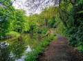
Follow the River Ayr along a pleasant woodland trail to Sorn, passing through Catrine Voes Local Nature Reserve and alongside the historic Catrine Weir. On reaching Sorn, cross the humpbacked ‘Auld Brig’ before passing through part of the village and into the “Spooky Woods”. The return route to Catrine is via Chapel Brae, a pleasant single track road which passes Catrine War Memorial.
Ballochmyle Viaduct from Catrine
 3.45 mi
+98 ft
-108 ft
1h 40
Easy
Departure from East Ayrshire
3.45 mi
+98 ft
-108 ft
1h 40
Easy
Departure from East Ayrshire
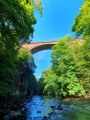
Starting in Catrine, follow the course of the River Ayr through woodland to the impressive Ballochmyle Viaduct. It is the highest masonry railway viaduct in Britain and even featured in a scene in the movie Mission: Impossible!
Ayr Gorge Woodlands Reserve, Failford
 3.55 mi
+302 ft
-312 ft
1h 55
3.55 mi
+302 ft
-312 ft
1h 55
 Moderate
Departure from South Ayrshire
Moderate
Departure from South Ayrshire
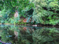
Ayr Gorge Woodlands reserve is the ‘jewel in the crown’ of the Scottish Wildlife Trust Ayrshire. Follow the path of the River Ayr as it flows through a deep red sandstone gorge. This circular / figure-of-eight route takes you around most of the main trails, giving you the opportunity to explore this beautiful ancient woodland including the popular viewpoint at Peden's Cove.
Peden's Cove, Failford
 1.93 mi
+187 ft
-161 ft
1h 05
Easy
Departure from South Ayrshire
1.93 mi
+187 ft
-161 ft
1h 05
Easy
Departure from South Ayrshire
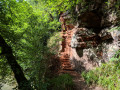
Peden’s Cove is hidden inside Ayr Gorge Woodland, a Scottish Wildlife Trust reserve. This beautiful and ancient woodland is formed around an incredible red sandstone canyon, which gives the water of the River Ayr a vibrant red appearance when the sun shines directly onto it! Peden’s Cove, a set of steps carved into the red sandstone cliffs, is reached a mile along the footpath.
River Ayr Way (Wellwood to Glenbuck Loch via Cairn Table)
 14.11 mi
+1,490 ft
-1,240 ft
7h 45
14.11 mi
+1,490 ft
-1,240 ft
7h 45
 Difficult
Departure from East Ayrshire
Difficult
Departure from East Ayrshire
A fairly challenging linear walk taking in the first section of the River Ayr Way as well as an ascent of Cairn Table (1945 ft / 593 m), the most prominent hill in East Ayrshire.
Afton Water and Glenafton from Danny's Brig
 Visorando Member2.25 mi
+66 ft
-52 ft
1h 05
Moderate
Departure from East Ayrshire
Visorando Member2.25 mi
+66 ft
-52 ft
1h 05
Moderate
Departure from East Ayrshire
A short walk down to the River Afton, upstream along a path for a mile and then back along a minor road to the parking spot.
Dismantled Railway, Darvel
 6.80 mi
+499 ft
-486 ft
3h 35
Easy
Departure from East Ayrshire
6.80 mi
+499 ft
-486 ft
3h 35
Easy
Departure from East Ayrshire
A linear walk from the village of Darvel along a fantastic disused railway track to the Spirit of Scotland Monument beneath Loudoun Hill.
Loudoun Hill Circular
 1.93 mi
+335 ft
-341 ft
1h 10
Difficult
Departure from East Ayrshire
1.93 mi
+335 ft
-341 ft
1h 10
Difficult
Departure from East Ayrshire
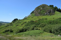
At just 361m elevation, the volcanic plug of Loudoun Hill near Darvel, is where Robert the Bruce had his first major military victory. Despite being small, it’s steep slopes certainly pack a punch and on a clear day the views from the top make it a must-do in the area. A favourite with children and adults alike!
For more walks, use our search engine .
The GPS track and description are the property of this route's author. Please do not copy them without permission.

