


Glen Afton Circular, New Cumnock
Details
Creation:
Last update:
-
 Activity: Walking
 -
 Distance: 5.99 mi
 -
 Duration calculated by the app: 3h 21
 -
 Difficulty: Easy
 -
-
 Back to start: Yes
 -
 Ascent: + 112 ft
 -
 Descent: - 112 ft
 -
-
 Highest point: 732 ft
 -
 Lowest point: 600 ft
-
 Country:
United Kingdom
Country:
United Kingdom
-
 City:
East Ayrshire
City:
East Ayrshire -
 Start/End: N 55.401979° / W 4.182518°
 -


 Hour-by-hour weather


Waypoints
- S/E : mi 0 - alt. 620 ft
- 1 : mi 1.31 - alt. 643 ft - Steep steps
- 2 : mi 4.15 - alt. 669 ft - Through gate then right, uphill
- 3 : mi 4.42 - alt. 643 ft - Turn right at play park
- 4 : mi 4.51 - alt. 627 ft - Feels like driveway - gate ahead
- 5 : mi 4.63 - alt. 627 ft - Turn left after passing beneath overhead cables
- 6 : mi 4.92 - alt. 610 ft - Left at bench
- 7 : mi 5.3 - alt. 614 ft - Keep left at fork beside 2 benches
- 8 : mi 5.49 - alt. 607 ft - Left at fork then left
- S/E : mi 5.99 - alt. 620 ft
Other walks in the area
Afton Water and Glenafton from Danny's Brig
 Visorando Member2.25 mi
+66 ft
-52 ft
1h 05
Visorando Member2.25 mi
+66 ft
-52 ft
1h 05
 Moderate
 Departure from East Ayrshire
A short walk down to the River Afton, upstream along a path for a mile and then back along a minor road to the parking spot.
Blackcraig from Afton Dam
 Association / Club / Walk leader6.13 mi
+1,460 ft
-1,490 ft
4h 05
Easy
Departure from East Ayrshire
Association / Club / Walk leader6.13 mi
+1,460 ft
-1,490 ft
4h 05
Easy
Departure from East Ayrshire
This walks brings you to Blackcraig summit past Blackcraig Farm.
Afton Dam Circular
 Tourism professional
 4.65 mi
+486 ft
-489 ft
2h 35
Easy
Departure from East Ayrshire
4.65 mi
+486 ft
-489 ft
2h 35
Easy
Departure from East Ayrshire
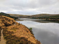
This walk takes you around the perimeter of Glenafton Reservoir just outside New Cumnock. On a still day the water creates stunning reflections of the surrounding hills and forests so remember to take your camera!
Windy Standard from Afton Dam
8.33 mi
+1,299 ft
-1,280 ft
5h 00
Easy
Departure from East Ayrshire
This walk brings you up Windy Standard from Afton Dam. Enjoy views of Afton Reservoir and wind turbines.
River Ayr Way (Wellwood to Glenbuck Loch via Cairn Table)
 14.11 mi
+1,490 ft
-1,240 ft
7h 45
14.11 mi
+1,490 ft
-1,240 ft
7h 45
 Difficult
Departure from East Ayrshire
Difficult
Departure from East Ayrshire
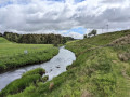
A fairly challenging linear walk taking in the first section of the River Ayr Way as well as an ascent of Cairn Table (1945 ft / 593 m), the most prominent hill in East Ayrshire.
Catrine to Sorn Loop
 4.71 mi
+325 ft
-322 ft
2h 25
Easy
Departure from East Ayrshire
4.71 mi
+325 ft
-322 ft
2h 25
Easy
Departure from East Ayrshire
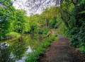
Follow the River Ayr along a pleasant woodland trail to Sorn, passing through Catrine Voes Local Nature Reserve and alongside the historic Catrine Weir. On reaching Sorn, cross the humpbacked ‘Auld Brig’ before passing through part of the village and into the “Spooky Woods”. The return route to Catrine is via Chapel Brae, a pleasant single track road which passes Catrine War Memorial.
Ballochmyle Viaduct from Catrine
 3.45 mi
+98 ft
-108 ft
1h 40
Easy
Departure from East Ayrshire
3.45 mi
+98 ft
-108 ft
1h 40
Easy
Departure from East Ayrshire
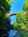
Starting in Catrine, follow the course of the River Ayr through woodland to the impressive Ballochmyle Viaduct. It is the highest masonry railway viaduct in Britain and even featured in a scene in the movie Mission: Impossible!
For more walks, use our search engine .
The GPS track and description are the property of this route's author. Please do not copy them without permission.

