


Gryffe Valley Way part 2 - Kilmacolm to Linwood
This walk is part of a multi-day hike: Gryffe Valley Way
Details
Creation:
Last update:
-
 Activity: Walking
 -
 Distance: 10.40 mi
 -
 Duration calculated by the app: 5h 59
 -
 Difficulty: Easy
 -
-
 Back to start: No
 -
 Ascent: + 13 ft
 -
 Descent: - 282 ft
 -
-
 Highest point: 312 ft
 -
 Lowest point: 20 ft
-
 Country:
United Kingdom
Country:
United Kingdom
-
 City:
Inverclyde
City:
Inverclyde -
 Start: N 55.893033° / W 4.629179°
 -
 End: N 55.854127° / W 4.501347°
 -


 Hour-by-hour weather


Waypoints
- S : mi 0 - alt. 302 ft - Carriages Restaurant
- 1 : mi 2.34 - alt. 190 ft - Turn right signposted Bridge of Weir
- 2 : mi 2.39 - alt. 187 ft - Left to cross bridge
- 3 : mi 4.51 - alt. 118 ft - Fork - down to river
- 4 : mi 6.83 - alt. 46 ft - Yew Tree
- 5 : mi 7.24 - alt. 26 ft - Extremely flooded track
- 6 : mi 10.26 - alt. 46 ft - Left
- 7 : mi 10.29 - alt. 39 ft - Left
- E : mi 10.4 - alt. 33 ft - ON-X Sports Centre
Other walks in the area
Corlic Hill, Clyde Muirshiel Regional Park
 Tourism professional
 5.88 mi
+489 ft
-479 ft
3h 10
5.88 mi
+489 ft
-479 ft
3h 10
 Moderate
Departure from Inverclyde
Moderate
Departure from Inverclyde
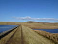
Good trails take you along to Corlic Hill summit (303 m / 994 ft) on the north-eastern perimeter of Clyde Muirshiel Regional Park, less than an hour's drive from Glasgow. On a clear day you will enjoy exceptional views down into the Clyde Valley, across to the Cowal Peninsula and over towards the southern Highlands. The return section takes you past the ancient ruins of Burnhead and Glenbrae farmsteads and between the tranquil Gryfe reservoirs.
Parkhill Wood, Castle Semple Country Park
 Association / Club / Walk leader
 2.41 mi
+226 ft
-253 ft
1h 20
Moderate
Departure from Renfrewshire
2.41 mi
+226 ft
-253 ft
1h 20
Moderate
Departure from Renfrewshire
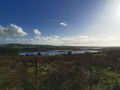
A pulse raising woodland walk suitable for those interested in increasing their heart rate!
Johnshill Loop, Clyde Muirshiel Regional Park
 Visorando Member2.61 mi
+200 ft
-187 ft
1h 20
Easy
Departure from Renfrewshire
Visorando Member2.61 mi
+200 ft
-187 ft
1h 20
Easy
Departure from Renfrewshire
A circular walk exploring Castle Semple Country Park’s Lochshore, Parkhill Wood and a wildflower meadow in Johnshill Field before returning through Lochwinnoch village.
Kenmure Hill, Clyde Muirshiel Regional Park
 6.04 mi
+276 ft
-279 ft
3h 00
Moderate
Departure from Renfrewshire
6.04 mi
+276 ft
-279 ft
3h 00
Moderate
Departure from Renfrewshire
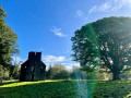
Climb the iconic Temple hill to see the remnants of the 18th Century Georgian designed landscape. Fabulous views across the historic Castle Semple estate and rural Renfrewshire.
The Greenock Cut
 7.22 mi
+315 ft
-344 ft
3h 35
Easy
Departure from Inverclyde
7.22 mi
+315 ft
-344 ft
3h 35
Easy
Departure from Inverclyde
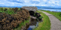
Designated as an Ancient Monument, The Greenock Cut is an aqueduct built in the 1820s to supply water from Loch Thom to Greenock. The 11.5km route is full of interesting features which is probably why it has been rated one of the top 50 walks in Scotland! It is an easy walk along surfaced minor roads, gravel tracks and grassy footpaths. You will be rewarded with fantastic views to Greenock, Gourock, the River Clyde and the southern Scottish mountains.
Shielhill Glen, Clyde Muirshiel Regional Park
1.58 mi
+144 ft
-144 ft
0h 50
Moderate
Departure from Inverclyde
Family-friendly woodland walk. A haven for many birds and animals this lovely circular offers a chance to walk part of the historic Kelly and Greenock Cuts as well as taking in a semi ancient woodland.
Loch Thom, Clyde Muirshiel Regional Park
5.45 mi
+194 ft
-200 ft
2h 40
Easy
Departure from Inverclyde
Circumnavigate Inverclyde’s largest loch with fine views across the Parks moorlands and hills. First known as the Great Reservoir or Little Caspian, it was later renamed in honour of the engineer who designed the Greenock Cut, Robert Thom.
Balloch Castle and Knockour Hill from the station
 6.13 mi
+751 ft
-741 ft
3h 30
Moderate
Departure from West Dunbartonshire
6.13 mi
+751 ft
-741 ft
3h 30
Moderate
Departure from West Dunbartonshire
This route offers train-loving travellers a stroll through Loch Lomond Country Park from Balloch station. You’ll walk alongside Balloch Castle Park before joining the circular loop over the hills of Knockour and Whinny. The paths are fully signposted and marked on various park maps. The starting point is directly at Balloch station, accessible from Glasgow Queen Street (Low Level) in 50 minutes by direct train.
For more walks, use our search engine .
The GPS track and description are the property of this route's author. Please do not copy them without permission.

