


The Affric Kintail Way
Details
Creation:
Last update:
-
 Activity: Walking
-
 Distance: 43.85 mi
-
 Average duration: 23h 15
-
 Difficulty: Difficult
-
-
 Back to start: No
-
 Ascent: + 3,507 ft
-
 Descent: - 3,583 ft
-
-
 Highest point: 1,142 ft
-
 Lowest point: 23 ft
-
 Country:
United Kingdom
-
 City:
Highland
-
 Start: N 57.335318° / W 4.479933°
-
 End: N 57.234987° / W 5.380158°
-


 Hour-by-hour weather


Waypoints
- S : mi 0 - alt. 98 ft
- 1 : mi 12.98 - alt. 220 ft - Campsite, pub, cafe, toilets
- 2 : mi 18.45 - alt. 636 ft - Toilets - Dog Falls Car Park
- 3 : mi 25.55 - alt. 781 ft - Toilets to the Right - River Affric Car Park. Rout
- 4 : mi 33.72 - alt. 866 ft - Altbeithe Hostel
- 5 : mi 34.31 - alt. 873 ft - Cross river here if low enough to save mileage
- 6 : mi 36.12 - alt. 1,076 ft - Camban Bothy
- 7 : mi 39.85 - alt. 171 ft - Glenlicht House (Edinburgh Uni Mountaineering Club
- E : mi 43.84 - alt. 23 ft - Morvich campsite
Other walks in the area
Divach Falls from Drumnadrochit
 Tourism professional
 4.64 mi
+476 ft
-476 ft
2h 35
 Easy
Departure from Highland
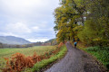
A circular walk through ancient woodlands and along pretty single track roads to reach the spectacular Divach Falls
Divach Falls via Craigmonie and Balmacaan Woods
 5.98 mi
+702 ft
-702 ft
3h 20
 Moderate
Departure from Highland
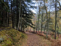
After an extended walk around Craigmonie Woods, quiet country roads lead you to Divach Falls.
Can na Laitire and Shieling hut, Abriachan Forest
 Association / Club / Walk leader
 5.89 mi
+748 ft
-719 ft
3h 20
Moderate
Departure from Highland
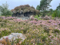
This walk takes is located in the Inverness and Lock Ness areas. It takes you through the hidden huts and art in the Abriachan Forest, up to the Can na Laitire which gives you nice views over Loch Ness before coming back past two interesting huts hidden in the landscape and the famous Great Glen Way.
Abriachan Forest hidden Tree houses
 0.95 mi
+69 ft
-66 ft
0h 30
Easy
Departure from Highland
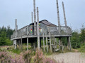
This easy walk takes you through the Abriachan Forest in the quest for huts, tree houses, and wildlife. It is an ideal walk for families.
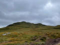
Meall Fuar-mhonaidh summit, Drumnadrochit
 5.65 mi
+1,657 ft
-1,650 ft
4h 00
Difficult
Departure from Highland
An incredible walk bringing you up to 360° views all over Loch Ness and Loch Nam Breac Dearga surroundings.
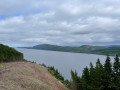
Crotaig circular
 1.36 mi
+226 ft
-249 ft
0h 50
Moderate
Departure from Highland
Gentle walk into the woods with some views of the Loch Ness.
Circular route through woodland along the shores of Loch Ness
 Visorando Member4.12 mi
+197 ft
-200 ft
2h 05
Easy
Departure from Highland
Start at Dores Beach, which has free parking. This is a circular walk through woodland that offers views of Aldourie Castle at the end, with the return route following the shores of Loch Ness, offering beautiful views and access to the lake. The walk follows forest tracks and paths.
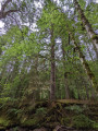
Tall Trees, Reelig Glen
 0.98 mi
+138 ft
-138 ft
0h 35
Easy
Departure from Highland
An easy circular walk along the Moniack Burn. Reelig Glen is home to some of the tallest trees in Britain and as you walk through this mossy woodland, you can't help but feel small compared to the massive fir and spruce trees towering above you. Information boards dotted along the trail offer ID opportunities and some fun facts.
For more walks, use our search engine .
The GPS track and description are the property of this route's author. Please do not copy them without permission.

