


RafRuns

 Visorando Member
 Premium user
 - Gender: woman
Sign up:
Published route(s)
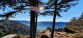
 Sternsee, Neuweiher lakes, Col des Charbonniers from Rouge Gazon
 8.28 mi
 +1,949 ft
 -1,942 ft
 5h 30
5h 30
 Difficult
 Departure from Saint-Maurice-sur-Moselle (Vosges)
This is a beautiful, fairly challenging route that will take you to Sternsee (Perch Lake), the Neuweiher lakes through the forest and stubble fields, then to the Col des Charbonniers before returning to Rouge-Gazon. You will be able to admire the view of the Alsace plain and the Alps on several occasions when the weather is fine.
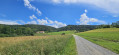
Morimont Castle via the source of the Largue and the Rocher de la Sorcière
 5.71 mi
+1,007 ft
-1,014 ft
3h 30
5.71 mi
+1,007 ft
-1,014 ft
3h 30
 Moderate
Departure from Oberlarg (Haut-Rhin)
Moderate
Departure from Oberlarg (Haut-Rhin)
The hike has been modified and no longer passes by the Ferme de la Vacherie.
A lovely little walk, mostly on fairly wide paths, leading to beautiful viewpoints and sites of historical interest such as the Mannlefelsen caves and Morimont Castle.
There is a slight incline on the first part of the route to add a little spice to this easy hike.