


Quichot

 Visorando Member
- Location: Gap (05000)
- Gender: man
Sign up:
Published route(s)
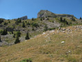
 Pas du Follet, foot of the Pic de Bure cliff
 4.94 mi
 +2,710 ft
 -2,710 ft
 4h 40
4h 40
 Moderate
 Departure from Saint-Étienne-en-Dévoluy (Hautes-Alpes)
A very beautiful hike that will take you to the foot of the famous Pic de Bure cliff and the "Desmaison" climbing route.
Superb view of the Dévoluy.
Please note that due to the risk of rockfalls, a prefectural decree dated 14/06/2014 prohibits access to the foot of the Bure cliffs until further notice.
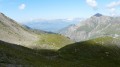
Col de la Coupa
 6.39 mi
+2,792 ft
-2,792 ft
5h 20
Moderate
Departure from Réallon (Hautes-Alpes)
6.39 mi
+2,792 ft
-2,792 ft
5h 20
Moderate
Departure from Réallon (Hautes-Alpes)
On the edge of the Écrins National Park, from the small hamlet of Les Gourmiers, a beautiful path leads us to the Col de la Coupa; the cliffs serve as a perch for vultures, which can be admired gliding over the magnificent Réallon valley.