OdB

 Visorando Member
 Premium user
 Sign up:
Published route(s)
 Around Issus through the ages

 5.67 mi
 +495 ft
 -505 ft
 3h 00
3h 00
 Moderate
 Departure from Issus (Haute-Garonne)
This walk will take you past the stately castle of Issus, then up the hillsides where you can admire the Lauragais countryside with an exceptional view of the Pyrenees. The route ends with a leap into modernity with the satellite dishes of a Telecom station.
Summit of Mont and Roche Ronde from Saurat
 8.17 mi
+2,375 ft
-2,395 ft
5h 50
Moderate
Departure from Saurat (Ariège)
8.17 mi
+2,375 ft
-2,395 ft
5h 50
Moderate
Departure from Saurat (Ariège)
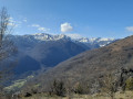
This hike will allow you to discover two remarkable sites, the Sommet du Mont and the Roche Ronde,
for the views they offer over the Tarascon valley and some of the peaks of the Pyrenees: Saint-Barthélémy and Pic des Trois Seigneurs.