


Maximsw

 Visorando Member
- Location: Mandelieu-la-Napoule (06210)
- Gender: man
- Website: https://www.youtube.com/channel/UCEsWz1FVje-TIRSh3K-Y-aQ
Sign up:
Published route(s)
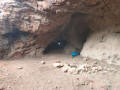
 La Dent de l'Ours, the Grotte de l'Utzel and the ravines of the Estérel
 11.09 mi
 +1,952 ft
 -1,946 ft
 6h 50
6h 50
 Moderate
 Departure from Théoule-sur-Mer (Alpes-Maritimes)
Hike in the Estérel to discover the caves and ravines: Ravin de l'Écureuil, Ravin de la Couche de l'Âne and Ravin de la Cadière. Beautiful views of the peaks, visits to caves and trails through the wild ravines of the Estérel.
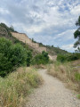
Malpasset Dam at the start of the Col d'Auriasque
 7.10 mi
+794 ft
-817 ft
3h 55
Moderate
Departure from Fréjus (Var)
7.10 mi
+794 ft
-817 ft
3h 55
Moderate
Departure from Fréjus (Var)
A pleasant hike in the Esterel to discover the Malpasset Dam and an ancient Roman bridge.
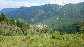
Arpille summit from Le Mas
 8.20 mi
+2,503 ft
-2,493 ft
5h 55
Moderate
Departure from Le Mas (Alpes-Maritimes)
8.20 mi
+2,503 ft
-2,493 ft
5h 55
Moderate
Departure from Le Mas (Alpes-Maritimes)
This round trip hike, starting from the charming village of Le Mas, takes you to the summit of L'Arpille. L'Arpille is considered one of the most beautiful viewpoints in the Alpes-Maritimes on the Mercantour.