


matreynet

 Visorando Member
 Premium user
 Sign up:
Published route(s)
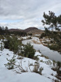
 La Croix de Berthel and the Pont du Tarn
 10.39 mi
 +1,424 ft
 -1,434 ft
 6h 00
6h 00
 Moderate
 Departure from Saint-Maurice-de-Ventalon (Lozère)
Route starting from the Col de la Croix de Berthel in the heart of the southern Cévennes. A day hike without any major difficulties.
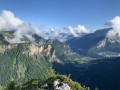
From Sixt-Fer-à-Cheval to Chamonix via the Anterne and Brévent passes
 11.79 mi
+6,348 ft
-3,556 ft
10 hrs
11.79 mi
+6,348 ft
-3,556 ft
10 hrs
 Very difficult
Departure from Sixt-Fer-à-Cheval (Haute-Savoie)
Very difficult
Departure from Sixt-Fer-à-Cheval (Haute-Savoie)
A beautiful hike through the Sixt-Passy Nature Reserve to Chamonix, climbing the Col d’Anterne and the Col du Brévent.
A very long hike that can be done in a day or over several days, staying at the Moëde Anterne or Alfred Wills mountain huts.
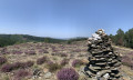
Col des Laupies circular starting from Plan de Fontmort
 9.61 mi
+1,565 ft
-1,565 ft
5h 45
Moderate
Departure from Cassagnas (Lozère)
9.61 mi
+1,565 ft
-1,565 ft
5h 45
Moderate
Departure from Cassagnas (Lozère)
This hike is accessible to everyone, young and old, in the Plan de Fontmort massif.
Part of the circular route is along the ridges with a view of Mont Aigoual, then descends to the refreshing Mimente before climbing back up the Chemin de Stevenson to Plan de Formont.