


lien

 Visorando Member
- Gender: woman
Sign up:
Published route(s)
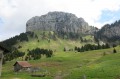
 Col de Cou, Col du Freu, Col du Câble
 6.05 mi
 +2,083 ft
 -2,067 ft
 4 hrs
4 hrs
 Extremely difficult
 Departure from La Roche-sur-Foron (Haute-Savoie)
A beautiful circular not far from Orange station, passing through three passes with a little adrenaline rush on the descent from the Col du Câble!
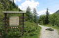
Loop: Posettes ridge and Vallorcine valley
 8.45 mi
+3,123 ft
-3,117 ft
6h 35
8.45 mi
+3,123 ft
-3,117 ft
6h 35
 Moderate
Departure from Chamonix-Mont-Blanc (Haute-Savoie)
Moderate
Departure from Chamonix-Mont-Blanc (Haute-Savoie)
Loop close to the Franco-Swiss border with a variety of exposures in a Nature Reserve (forest to the East, long ridge, alpine pasture, forest to the west), with a beautiful 360° panoramic view and a belvedere ideal for picnics.