


lducken1

 Visorando Member
 Premium user
 Sign up:
Published route(s)
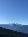
 Randonnée sur la crête de la Pointe de Chamossière, Lac de Joux Plan, Les Gets
 3.60 mi
 +1,352 ft
 -1,325 ft
 2h 50
2h 50
 Moderate
 Departure from Verchaix (Haute-Savoie)
Un circuit qui comprend une superbe randonnée sur une crête avec vue sur la vallée glaciaire de Samoëns et Sixt-Fer-à-Cheval, tout en étant dominé par le Mont Blanc.
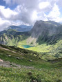
Lac de Montriond to Roc de Taveneuse, views to Lac de Taveneuse & Abondance
 6.58 mi
+3,543 ft
-3,543 ft
6h 05
6.58 mi
+3,543 ft
-3,543 ft
6h 05
 Difficult
Departure from Montriond (Haute-Savoie)
Difficult
Departure from Montriond (Haute-Savoie)
A there and back hike up to Roc de Taveneuse with views across to Abondance. This hike offers a challenging initial forest climb (hard relentless cardio but no rock climbs or cables/supports) but then opens up to mountain pastures with full panoramic shot of Mont Blanc (on a clear day). A further climb brings you to Roc de Tavaneuse with 360 views.
Ridgeway Loops from Ashridge
9.98 mi
+1,040 ft
-1,024 ft
5h 30
Moderate
Departure from Aldbury (Hertfordshire)
A circular trail near Berkhamstead covering the Ridgeway, Grim's ditch, Pitstone Hill, Steps Hill, Ivinghoe Beacon, Beacon Hilll, Icknield Way trail. Starting at Ashridge monument where there is national trust parking.