


jacthy

 Visorando Member
 Premium user
 - Gender: man
Sign up:
Published route(s)
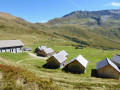
 Les Sources de l'Arve
 6.75 mi
 +2,615 ft
 -2,585 ft
 5h 25
5h 25
 Moderate
 Departure from Chamonix-Mont-Blanc (Haute-Savoie)
With a group of senior hikers from the Arve Valley, we set off down the Arve River from its source at La Jonction, Geneva, to its confluence with the Rhône.
A short one-day circuit, ascending via the balconies and descending as close as possible to the river, the SM3A path.
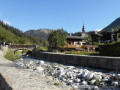
Loop from Argentière to Le Tour
 6.10 mi
+1,572 ft
-1,545 ft
4h 10
Moderate
Departure from Chamonix-Mont-Blanc (Haute-Savoie)
6.10 mi
+1,572 ft
-1,545 ft
4h 10
Moderate
Departure from Chamonix-Mont-Blanc (Haute-Savoie)
After the sources of the Arve, the second loop of the Arve starts from Argentière and takes you on a balcony to the village of Le Tour. The return journey is via Tré-le-Champs, with beautiful panoramic views of the Mont Blanc Massif.
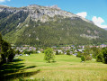
The Tines loop via Argentière
 6.83 mi
+1,017 ft
-991 ft
4h 00
Moderate
Departure from Chamonix-Mont-Blanc (Haute-Savoie)
6.83 mi
+1,017 ft
-991 ft
4h 00
Moderate
Departure from Chamonix-Mont-Blanc (Haute-Savoie)
3rd° loop of the Arve descent, from Les Tines, up through Le Lavancher and Petit Balcon Nord, superb scenery and a very pleasant forest crossing, and a descent as close as possible to the river.