


Esperal

 Visorando Member
 Premium user
 Sign up:
Published route(s)
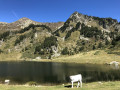
 Estany de la Balmeta and Puig Péric from Les Angles

 11.61 mi
 +3,219 ft
 -3,212 ft
 7 hrs
7 hrs
 Very difficult
 Departure from Les Angles (Pyrénées-Orientales) (Pyrénées-Orientales)
A varied hike (forest, lake, pastures, rocky peaks) leading to a beautiful summit with magnificent views. Two-thirds of the route is unmarked, but the path is visible thanks to cairns. The descent along the ridges gives you time to take it all in.
Caution: there are vertiginous sections, even though there is no climbing involved and a path runs along the ridges; check the weather forecast as clouds coming in from the Ariège can spoil everything, and damp conditions make the rocks slippery.
Refuge des Fornells and Coll del Pam from Pyrénées 2000
4.34 mi
+653 ft
-656 ft
2h 35
 Easy
Departure from Font-Romeu-Odeillo-Via (Pyrénées-Orientales)
Easy
Departure from Font-Romeu-Odeillo-Via (Pyrénées-Orientales)
A lovely circular walk in the forest, from Pyrénées 2000 to Coll del Pam (col du lopin de terre). Viewpoint over the mountains from Carlit to Canigou at the end.
 Moderate