


cpoupard

 Visorando Member
 Premium user
 Sign up:
Published route(s)
 A walk in the Montmorency forest
 4.07 mi
 +226 ft
 -226 ft
 2h 05
2h 05
 Easy
Easy
 Departure from Saint-Leu-la-Forêt (Val-d'Oise)
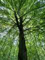
A pleasant circular with a moderate elevation gain, in the chestnut grove of one of the green lungs of the Ile-de-France region. In autumn, families can come and collect chestnuts.
The Téméraire circular at Saint-Benoît-la-Forêt
 4.92 mi
+302 ft
-266 ft
2h 30
Easy
Departure from Saint-Benoît-la-Forêt (Indre-et-Loire)
4.92 mi
+302 ft
-266 ft
2h 30
Easy
Departure from Saint-Benoît-la-Forêt (Indre-et-Loire)
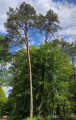
This circular walk takes you to the clearing where Saint-Benoît-la-Forêt is nestled, in the heart of the Chinon state-owned forest. It alternates between clearings, dense undergrowth and open woodland, and allows you to explore part of the Saint-Benoît nature trail.
The Châtelier circular starting from Saint-Benoît-la-Forêt
 4.38 mi
+203 ft
-203 ft
2h 10
4.38 mi
+203 ft
-203 ft
2h 10
 Moderate
Departure from Saint-Benoît-la-Forêt (Indre-et-Loire)
Moderate
Departure from Saint-Benoît-la-Forêt (Indre-et-Loire)
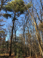
This circular route above Saint-Benoît takes you through beautiful deciduous and coniferous forests, before exploring a valley accessible to the most determined walkers.
It can be combined with the Téméraire circular loop to double the length of the route. In this case, it is recommended to tackle the Téméraire first, followed by the Châtelier.