


claudeRdR

 Visorando Member
 Premium user
 Sign up:
Published route(s)
 The Curlet Cross
 3.57 mi
 +1,867 ft
 -1,844 ft
 5 hrs
5 hrs
 Moderate
 Departure from Saint-Véran (Hautes-Alpes)
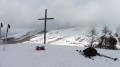
From the Curlet cross, there is a superb view of Saint Véran, the highest village in Europe, and the entire upper Queyras, from the Col d'Izoard to the Col Agnel.
 Tour de la Viste
 11.47 mi
+2,959 ft
-2,949 ft
7h 50
Moderate
Departure from Rousset (Hautes-Alpes)
11.47 mi
+2,959 ft
-2,949 ft
7h 50
Moderate
Departure from Rousset (Hautes-Alpes)
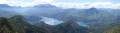
La Viste is a peak overlooking the Serre-Ponçon dam. Walking around it offers beautiful views of the lake, as well as the surrounding mountains (Ecrins massif, Ubaye) and the Durance valley.
Please note that this hike should only be undertaken in good weather, with no risk of storms, as it involves fording numerous streams. In addition, a short section on a very steep slope, which is actually easy, may cause discomfort for those prone to vertigo.