


chirouge

 Visorando Member
- Location: Saint-Hilaire-du-Rosier (38840)
- Gender: man
Sign up:
Published route(s)
 The Crêtes de Saint-Lattier
 9.03 mi
 +1,371 ft
 -1,362 ft
 5h 20
5h 20
 Moderate
 Departure from Saint-Lattier (Isère)
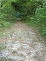
You will start at the lowest point in Saint-Lattier and climb to the highest point, where you will enjoy a 360° view of the Vercors, Drôme and Ardèche mountains. The cobbled climb, an ancient medieval road, leads to Bel Aire. Along the way, you can admire the paving, the structures from the period and the ruts carved out by the carts and wagons that used to travel to the castle mound known as "Le Pain Sucre", which dominates the Saint-Lattier valley.