


Bastien Mallein

 Visorando Member
- Gender: man
Sign up:
Published route(s)
 Giroussens ridge road
 3.29 mi
 +233 ft
 -213 ft
 1h 45
1h 45
 Easy
Easy
 Departure from Giroussens (Tarn)
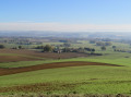
This short hike in the commune of Giroussens, near the Jardin des Martels, offers a series of beautiful views of Lavaur, Ambres and the Dadou valley.
Short loop around Giroussens
 6.51 mi
+358 ft
-341 ft
3h 20
Easy
Departure from Giroussens (Tarn)
6.51 mi
+358 ft
-341 ft
3h 20
Easy
Departure from Giroussens (Tarn)
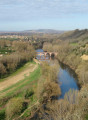
This short loop will allow you to explore the area around the town of Giroussens. During this hike, you will pass through the centre of Giroussens, allowing you to discover this medieval village. You can enjoy superb views of the Agoût and Dadou valleys. The hike also passes through the Giroussens forest, as well as near private forests: please keep your dogs on a leash.
Long circular loop of Giroussens and Saint-Anatole
 9.36 mi
+410 ft
-423 ft
4h 40
9.36 mi
+410 ft
-423 ft
4h 40
 Moderate
Departure from Giroussens (Tarn)
Moderate
Departure from Giroussens (Tarn)
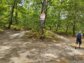
This hike will allow you to discover the territory of the commune of Giroussens. Starting from the centre of this medieval village, you will enjoy beautiful views of the Agoût and Dadou valleys. After passing near Saint-Anatole, the route ends with a walk through the forest of Giroussens.