


TraceMapper

 Visorando Member
 Premium user
 - Location: Montpellier (34080|34070|34000|34090)
- Gender: man
Sign up:
Published route(s)
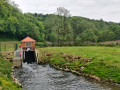
 Along the Chiers between Lexy and Cons-la-Grandville
 6.30 mi
 +433 ft
 -456 ft
 3h 15
3h 15
 Average
 Departure from Lexy (Meurthe-et-Moselle)
A walk along the Chiers, on a mainly tarmac-surfaced and easily accessible route. This walk takes you close to former industrial and production sites that are now disused. In the tranquillity of the forest, imagine the hum of activity from days gone by still echoing amongst the trees and the remnants of the past.
Tamaris Trail along the banks of the Étang du Méjean
 4.70 mi
+7 ft
-7 ft
2h 10
4.70 mi
+7 ft
-7 ft
2h 10
 Easy
Departure from Lattes (Hérault)
Easy
Departure from Lattes (Hérault)
Trail open from 9am to 6pm. Closed on Mondays.
In the heart of the Méjean nature reserve, set off to explore a unique landscape where ponds, reed beds and the wild spaces typical of the Camargue come together. The well-maintained trail, dotted with wooden footbridges, invites you to immerse yourself in remarkable flora and fauna: storks, flamingos, herons, coypu, Camargue horses and even bulls roam this unspoilt environment. A peaceful and accessible walk, ideal for a family outing in the heart of nature.