


Ydderf

 Visorando Member
 Premium user
 Sign up:
Published route(s)
 Falmignoul, the Rocher de Freyr and the waterfall
 9.20 mi
 +876 ft
 -873 ft
 5h 00
5h 00
 Moderate
 Departure from Dinant (Province de Namur)
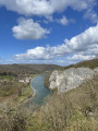
A lovely, fairly challenging walk for the first 7 kilometres, as some sections are quite narrow with slippery descents in wet weather. There are some very beautiful views, including the Rocher de Feyr. The return route takes you through the countryside along the water’s edge, up to the waterfalls, and finishes with a country lane that leads back to the starting point.
To the Pont du Sanglier from Redu
6.89 mi
+860 ft
-856 ft
3h 55
 Easy
Departure from Libin (Province de Luxembourg)
Easy
Departure from Libin (Province de Luxembourg)
A lovely walk of nearly 11 km, mostly along the banks of the Lesse and through the woods.
Start from the centre of Redu near the tavern.
There you’ll find a small beach (1) where you can have a picnic or dip your toes in the water.
The route is fairly easy, although there are a few short climbs, but nothing too difficult.
I simply crossed the Lesse at (5) about 750 m from the Pont du Sanglier (4) – the water was 30 cm deep – to follow the riverbank in the opposite direction; otherwise, you can turn around and retrace your steps to rejoin the route at the Pont du Sanglier.
And to finish off, enjoy a drink on the terrace at the tavern at the starting point.