


Entiz

 Visorando Member
Sign up:
Published route(s)
 Ascent to La Rhune from the station at Col de Saint-Ignace
 3.32 mi
 +2,418 ft
 -2,966 ft
 3h 40
3h 40
 Moderate
 Departure from Sare (Pyrénées-Atlantiques)
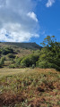
From the Rhune mini-train station, this hike climbs to the summit at 905 metres. The trail crosses moors, pastures and small woods, offering progressive views of the Basque Coast and the Pyrenees. Along the way, pottoks and mountain birds punctuate the ascent. At the summit, the 360° panorama reveals the ocean on one side and the Pyrenean mountain range on the other, rewarding your efforts with a spectacular natural spectacle.